The map of the world looked very different 240 million years ago.
Earth's modern-day continents were joined together in one Pac-Man-shaped supercontinent known as Pangea, which eventually split into two fragments: Laurasia in the north and Gondwana in the south.
The former became Europe, Asia, and North America. The latter dispersed to form modern-day Africa, Antarctica, South America, and Australia.
But now, scientists have discovered the fate of a fifth continent that was born from Gondwana's bosom, which they named Greater Adria.
A study published last week showed that geologic forces slowly shoved the Greenland-sized land mass underneath southern Europe between 120 million and 100 million years ago.
The continent was already half-submerged to start, but as it rumbled toward the Earth's mantle (the rocky inner layer of our planet), its top layer got peeled away, jutting up to become fodder for mountains in what are now 30 European countries.
Douwe van Hinsbergen, the lead author of the study, compared Greater Adria's subduction to the act of shoving a clothed arm below a table's edge.
"Suppose you have a sweater on," he told Business Insider. As you push your arm under the table, the sweater sleeve stays behind, getting folded and jutting upward.
The folded sleeve is the "equivalent of the upper few kilometers of Adria's crust, and your arm is the plate that is now sinking in the mantle, hundreds or even thousands of kilometers below our feet," van Hinsbergen said.
Those "sweater folds" became Eurasian mountain belts like the Apennines in Italy, the Dinarides in Bosnia and Herzegovina, the Swiss Alps, the Zagros mountains of Iran, and the Himalayas.
Reconstructing Greater Adria's geologic history
In order to piece together Greater Adria's past, van Hinsbergen and his colleagues spent a decade aggregating geological data from countries across Europe, North Africa, and western Asia.
Naturally occurring magnets in the Earth's crust can help scientists track 240 million-year-old tectonic-plate movements. When hot lava cools at the boundary between two shifting plates, it traps rocks containing magnetic minerals that align with the Earth's magnetic fields at the time.
The rocks keep that alignment, so scientists can use their orientation to calculate where those magnets were on the planet millions of years ago.
 (Douwe van Hinsbergen)
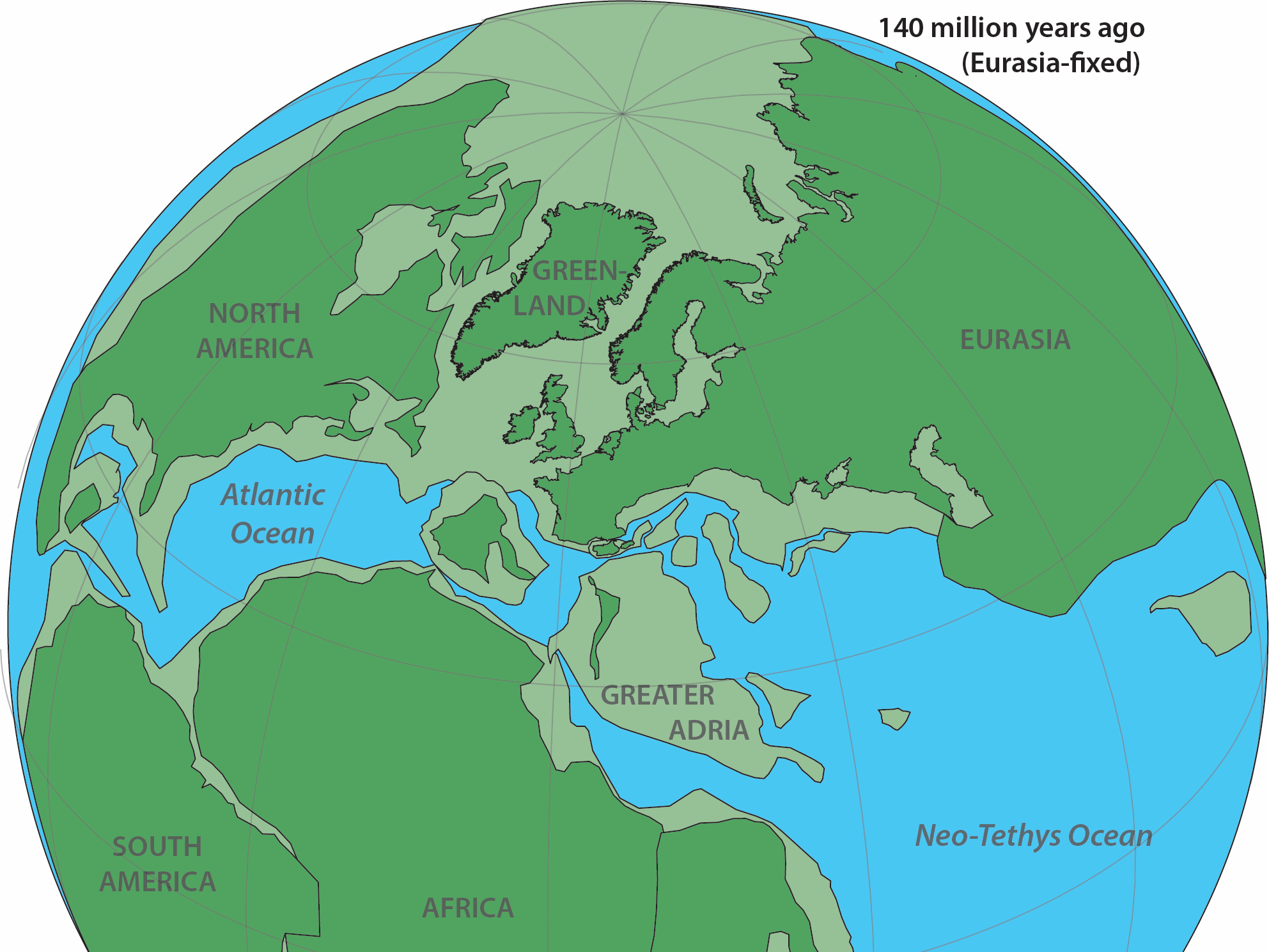
Above: Earth's land masses 140 million years ago, above the water (dark green) and submerged (light green).
The researchers looked at magnetic rocks from 2,300 ancient sites across the Mediterranean region. Then they used that data to create computer simulations of the movements of Earth's tectonic plates before, during, and after Greater Adria's descent into the mantle.
The researchers determined that the hidden continent broke off of what is now Africa 220 million years ago, then further splintered away from what became the Iberian Peninsula 40 million years later.
By about 140 million years ago, van Hinsbergen told Live Science, Greater Adria was likely a string of archipelagos.
At that time, Adria probably looked like modern-day Zealandia, the minicontinent that underpins New Zealand's north and south islands. Only 7 percent of Zealandia is above sea level.
Then, between 120 million and 100 million years ago, the jostling of Earth's tectonic plates forced Greater Adria down into the mantle, under what is now Southern Europe.
"The deepest portions are now at a 1,500-kilometre (932-mile) depth below Greece," van Hinsbergen said.
The study authors also discovered that some splinters of Greater Adria didn't subduct under Europe and instead remained above sea level. They eventually became parts of Italy, like Turin and Venice, and the Istria region of Croatia.
Knowing what the Earth looked like millions of years ago might aid the search for valuable mineral deposits
According to van Hinsbergen, reconstructions of our planet's geologic history can help countries and companies looking to mine valuable mineral deposits because scientists can highlight regional patterns in the way certain magnetic materials are deposited in the Earth's crust.
"Metals, ceramics, building materials, everything came out of a rock," he said. "You don't find the next gold or copper mine, or the 25 materials you've never even heard of that make your iPhone work, by taking a stroll in the woods."
Geologic reconstructions could also help researchers better understand how existing mineral and ore deposits – ones we already know about – formed and where any remaining materials might be buried.
This article was originally published by Business Insider.
More from Business Insider: