Right now the average lead time for a tornado warning in the US is 13 minutes, but a new prediction system promises to push that out to an hour or beyond: it's called Warn on Forecast (WoF), and it's just been successfully tested for the first time.
The system is being developed by the National Severe Storms Laboratory at the NOAA (National Oceanic and Atmospheric Administration), and once it goes live it could be massively helpful for those in charge of evacuating large numbers of people.
Warn on Forecast could eventually provide severe weather warnings up to three hours in advance, say the researchers working on the technology, and in the case of its first trial run it gave Oklahoma residents 90 minutes to brace themselves for large hail and tornadoes.
"We had a picture of the storms and their evolution before they became life-threatening," says one of the team, science operations officer Todd Lindley. "We used this model guidance to forecast with greater lead time and greater confidence."
Today, tornado warnings are issued by forecasters manually studying satellite data and volatility in the atmosphere, but WoF takes in more data and analyses its patterns in ways human brains aren't equipped to.
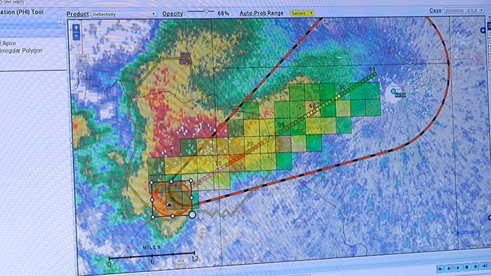 WoF produces a "firehose" of data, say researchers. Credit: NOAA
It works through the power of big data: massive amounts of satellite, radar, and surface readings are fed into a sophisticated prediction model that tries to work out how the weather will develop next.
In fact the system pumps out so much data that the NOAA is developing another technology called FACETs – Forecasting a Continuum of Environmental Threats – to help forecasters make sense of what's coming in and pick out the most significant trends.
Together, FACETs and WoF can give the probability of hazardous weather in half-mile (800 metre) blocks every two minutes. On their own, WoF forecasts update every 15 minutes.
And in the case of the storm that hit Oklahoma, the prototype WoF technology was able to identify a specific area in eastern Texas as the likely starting point for weather that could put lives at risk.
"That level of detail and lead time in a forecast is new," says Steve Koch from the NOAA's National Severe Storms Laboratory. "To have information conveying a sense of certainty in so small of an area that far in advance is a success."
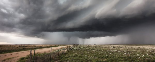
An hour and a half after the Particularly Dangerous Situation (PDS) tornado watch alert was issued, an EF-2 tornado hit the area around Elk City, resulting in one death, multiple injuries and the damage or loss of around 200 homes.
The NOAA hasn't set a date for when Warn on Forecast will go live – it says there's still plenty of work to do – but in the long term it could provide advance warning of severe weather that makes all the difference to people on the ground.
With around a thousand tornadoes recorded every year in the US, the technology can't arrive quickly enough, especially as the most severe type of outbreaks – where six or more tornadoes happen close together – are becoming more common.
The NOAA is also consulting with behavioural scientists to weigh up the best way of communicating all this new information. The longer the lead time of the warning the better, but it's also important that people don't get complacent or wait too long before finding shelter.
"I'm really excited about this new approach being tested by NOAA," meteorologist Bob Henson, from Weather Underground, told Ryan F. Mandelbaum at Gizmodo.
"Warn on Forecast is a very promising bridge between observations and computer models. It merges the two, with enough detail in time and space to determine if tornadoes are likely within a tightly defined area within an hour or so."
The NOAA has produced a video showing how WoF works, which you can see below:
