A series of snowstorms have swept across the Midwest in the past week, making a mess of roads and trailing freezing temperatures across the region.
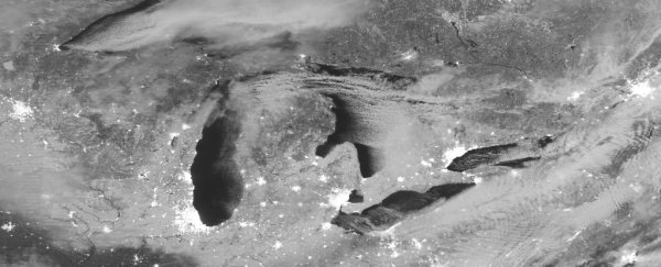
It's not much fun to trudge through, but it sure is pretty to look at. Have a gander at the above image, which I first saw tweeted from the UW-Madison Cooperative Institute for Meteorological Satellite Studies feed.
Taken from space before dawn Thursday morning, the photo shows a vast, snow-covered region stretching from north-central Canada to Indiana, lit up by moonlight.
 NASA/UW-Madison CIMSS
You can see the Great Lakes, with the lights of major cities like (from West to East) Chicago, Detroit, Cleveland, and Toronto sprouting from their edges.
At the far western end of the image is Minneapolis, and you can spot the coastal cities to the east.
South of Chicago and Detroit, before St. Louis, the white snow on the ground gives way to white clouds.
The image comes from NASA's satellite-mounted Visible Infrared Imaging Radiometer Suite (VIIRS), which takes photos of Earth that are also used to provide key data on ocean health, air quality, land, and clouds.
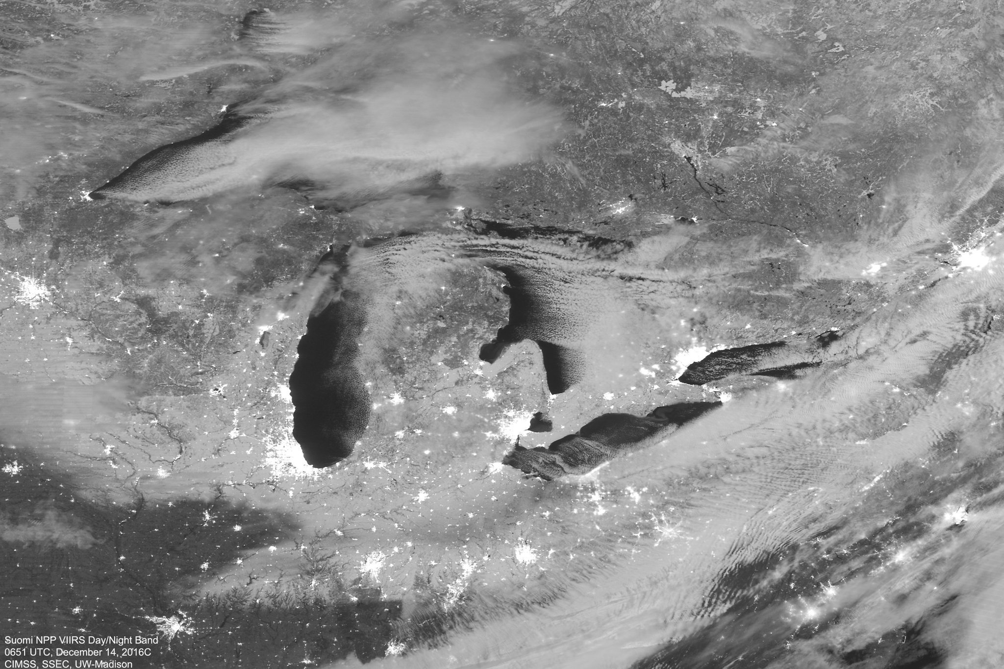
Here's another, daytime photo from NASA's MODIS satellite of the Lake Michigan area.
More #LakeEffectSnow for Michigan! Stunning imagery via @NASA Aqua #MODIS. #miwx https://t.co/jJ7rvIqQTT pic.twitter.com/rfKEs7C1RX
— UW-Madison CIMSS (@UWCIMSS) December 14, 2016
This article was originally published by Business Insider.
More from Business Insider: