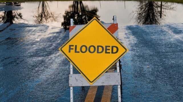
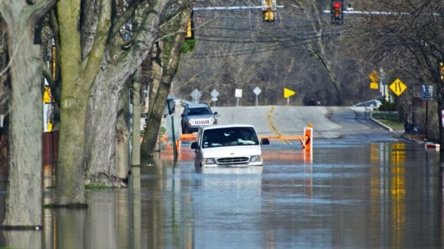
WASHINGTON (AP) – More than 17 million people along the US Atlantic and Gulf coasts are at the highest risk of being affected by flooding, with New York and New Orleans standing out, according to one of the most comprehensive studies ever of flood risk.
Researchers at the University of Alabama used 16 different factors, including the geographic hazards, the population and infrastructure exposed, and the vulnerability of people living there.
They then brought in past damages from the Federal Emergency Management Agency's (FEMA) database and applied three different artificial intelligence tools to figure out flood risks from Texas to Maine, calculating that 17.5 million people were at "very high" risk and an additional 17 million were at "high" risk, the next level.
The authors looked at all sizes of flooding and examined separately what FEMA considers the most extreme, which are the top 1% of events.
The study found that 4.3 million people along the coasts were at the highest risk of extreme flooding, and 20.5 million were at high risk, the second-highest level.
They found a lot of vulnerabilities, highlighting eight different cities from Houston, which flooded in 2017's Hurricane Harvey, to New York, which was inundated in 2012's Superstorm Sandy.
Wednesday's study in the journal Science Advances found that New York City has 4.75 million people at the two highest risk levels for all flooding, with more than 200,000 buildings likely to be damaged.
And while the number of people at risk in New Orleans is far lower, about 380,000, it involves 99% of the city's population.
That doesn't mean 99% of the people will be affected in the next hurricane or nontropical flood, but that they might be depending on the storm's individual path and rain pattern, said study co-author Wanyun Shao, a climate scientist at the University of Alabama.
"Just look at the magnitude," Shao said. "Those numbers are shocking, are alarming."
"When the next big storm hits New York City, when the next Hurricane Katrina -like hurricane makes landfall in New Orleans, people will get hurt, especially those socially vulnerable populations," Shao said, referring to the poor, the elderly, children, and the uneducated.
Shao and outside experts said the numbers stunned them, even though they were familiar with the worsening effects of climate change.

"New York is known to be susceptible to floods, and it has the largest population," said Alex de Sherbinin, a Columbia University geographer who wasn't part of the study.
"But the fact that New York has nearly an order of magnitude more flood-exposed population than any other city is surprising."
Flood problems are becoming more frequent in New York and New Orleans because of human-caused climate change, the study said. Other cities are also threatened.
Jacksonville has 679,000 people at high or very high risk of flooding, while Houston is just behind at just under 600,000. Other cities highlighted include Miami, Norfolk, Virginia, Charleston, South Carolina, and Mobile, Alabama.
Shao and outside experts said what separates her study from others is the sheer comprehensiveness of all the factors it considers, including sinking land and pavement that doesn't allow water to seep into the ground, as well as incorporating human social vulnerability, such as poverty and age.
"This could be applied to other places in the world, such as Manila," said University of Virginia engineering professor Venkataraman Lakshmi, who heads the hydrology section of the American Geophysical Union, referring to the capital of the Philippines.
Lakshmi wasn't part of the study, but he said the flooding problems it highlights will get more frequent and intense due to human-caused climate change.
Columbia University's Marco Tedesco, who wasn't part of the study, said "It reinforces the crucial concept that future flood disasters are not just about water – they are about where people live, how cities are built, and who is least protected."
Related: Scientists Reveal 4 Stark Options For Saving Venice From Rising Seas
De Sherbinin said, "The analysis of the flood risk factors is important for local planners, emergency managers, and even highway crews and utility providers. We all know that low-lying areas are more flood-prone, but the data they have assembled provides more insights into flood risk, particularly for flash floods."
Study lead author Hemal Dey, a geospatial scientist, said he hopes local officials look at not just building more dams and levees, but also more natural infrastructure such as wetlands, grasslands, rain gardens, and estuaries.
"The research is solid confirmation of what emergency managers have been saying for years," said Craig Fugate, a former FEMA director who wasn't part of the study. "The harder question is what we're actually going to do about it."
The research has been published in Science Advances.