It turns out that not all roads lead to Rome, after all – at least, not in a literal sense.
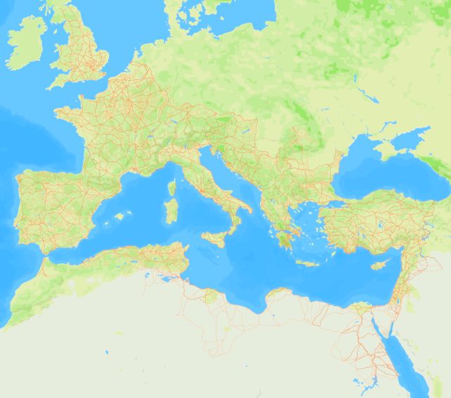
A new map of the empire's ancient land routes has nearly doubled the length of the confirmed ancient Roman road network, from 190,000 to 300,000 kilometers (118,000 to 186,000 miles) – with the major hubs located far from Rome itself.
And yet, the map – named Itiner-e, and made publicly available – represents, at most, just 3 percent of the entire Roman road network, says a team led by archaeologist Tom Brughmans of Aarhus University.
Related: We Finally Know Why Ancient Roman Concrete Stood The Test of Time
"This was a huge surprise and a sobering realization: Roads are one of the most enigmatic topics in Roman archaeology and history, they were all over the place, we have proverbs like 'all roads lead to Rome'. How can it be that we only know the location of 3 percent with certainty?" Brughmans told ScienceAlert.
"This is in fact a hugely constructive finding. Thanks to our work, we know that localizing Roman roads precisely requires more research attention."
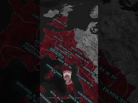
The ancient Roman Empire was hugely influential, with a far-reaching dominion that, at its peak, spanned 5 million square kilometers, controlled from the hub of Rome near the coast of Italy. Today, its echoes live on – its literature and propaganda, its graffiti, its art, and its architecture.
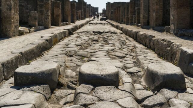
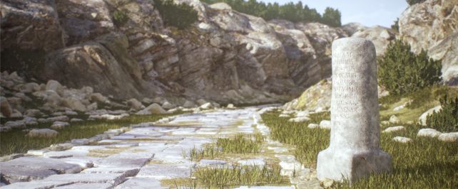
Its road network was also the stuff of legend – a vast web spanning the empire, credited with playing a crucial role in the expansion and maintenance of Rome. Such was their craftsmanship and record-keeping that, even thousands of years later, we still find those ancient paths, sometimes in the most unexpected places.
Roads can teach us a lot about the ancient Romans, such as how they moved around and traded with each other, the extent and timeline of the empire's reach, and how disease spread. Yet the available data on the Roman road network was old and fragmentary.
Brughmans and his team embarked on the Itiner-e project to centralize the map in one place and make that information freely available to anyone who wished to use it.
"The main contribution of the project is that it brings together all of that research about Roman road locations in an open and accountable way: Each of the 14,769 road segments includes the sources used to localize it and an expression of the certainty of the location," he explained.
"This is the first open dataset that combines research about the location of all Roman roads across the entire empire. They have been studied for over 200 years, and we should have a reliable resource that makes these scholarships available to everyone."
The effort aimed to bring all the available data together, building on previous work such as the Digital Atlas of Roman and Medieval Civilizations (DARMC) map based on the 2000 Barrington Atlas of the Greek and Roman World, historical itinerary records, Roman milestones, archaeological site data, historical maps compiled in the 1800s and 1900s, and the most recent scholarship identifying new roads.
"We compared evidence from excavations and literary sources with satellite photography to identify traces of ancient roads, and historical topographic maps showing a time before dense urbanization when Roman roads could have been more visible," Brughmans said.
"We can even find roads hidden beneath current dam lakes by using historical satellite images taken before the damming project."
The result is a dataset that covers 40 countries, expanding the 188,554.7 kilometers in DARMC to 299,171.31 kilometers of known Roman roads.
"That's over seven times the circumference of the Earth," Brughmans said.
"This period fundamentally restructured transport infrastructure in the region, on a scale unseen until the industrial revolution in the 19th century, and we now have the dataset that allows us to study how terrestrial mobility changed over 2,000 years."

Fascinatingly, as the researchers noted, there's an astonishing level of use continuity in Roman roads over the last 2,000 years, with many of the routes still in use today. Although the empire itself is long gone, the ghost of its reach lives on in the highways that connect the world.
As for where they lead? The major hubs, the map shows, were the Po Valley and Alpine corridor in northern Italy; Rome's location on a peninsula meant that, at least as far as overland networks go, it ended up being something of a cul-de-sac. It's only when factoring in maritime and river routes that Rome becomes the center of its empire.
Related: Oldest Known Maya Monument Could Be a Map of The Universe
Meanwhile, the team plans to continue extending Itiner-e, hopefully building the most comprehensive map of Roman roads that the world has ever seen.
"Three hundred thousand kilometers is really only the tip of the iceberg," Brughmans said. "We hope to stimulate future work to improve the open knowledge of where all Roman roads are."
The research has been published in Scientific Data, and you can explore Itiner-e for yourself here.