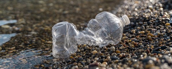
If we're going to tackle our microplastic pollution problem, then we need a better understanding of where these fragments and particles are – and a new study suggests that adapting satellite measurements could be one way of doing just that.
At the moment, estimates of microplastics in the ocean rely on trawling specific areas with nets, and assessing movement based on ocean circulation patterns. There's a lot of room for improvement when it comes to figuring out where these plastic particles are and how they might be moving over time.
That's where satellite readings come in, and in particular satellite readings of ocean surface roughness from the Cyclone Global Navigation Satellite System (CYGNSS) weather satellites: this roughness seems to correlate to the presence of microplastics.

"We'd been taking these radar measurements of surface roughness and using them to measure wind speed, and we knew that the presence of stuff in the water alters its responsiveness to the environment," says climate and space scientist Chris Ruf, from the University of Michigan.
"So I got the idea of doing the whole thing backward, using changes in responsiveness to predict the presence of stuff in the water."
Ruf and his colleagues think that what the satellites are picking up are surfactants – oily compounds that usually accompany microplastics in the water, and which lower the surface tension where the ocean meets the air.
When the researchers matched their satellite readings and predictions with actual measurements and current models of ocean microplastics, they found a strong correlation, suggesting that the technique works.
It would mean a much more accurate picture of microplastic pollution in the oceans is now possible. The satellite readings showed plastic peaks in the North Atlantic and Pacific during the Northern Hemisphere's summer months, for example, while concentrations in the Southern Hemisphere peak during January and February.
This innovative new tracking method also means that sources of microplastics can be identified more easily. The new data show spikes in microplastic concentrations at the mouth of the Yangtze River, for instance, long thought to be a major source of this type of ocean pollution.
"It's one thing to suspect a source of microplastic pollution, but quite another to see it happening," says Ruf. "The microplastics data that has been available in the past has been so sparse, just brief snapshots that aren't repeatable."
With around 8 million tons of plastic thought to enter the oceans each year, cleaning it up is already a massive undertaking. Knowing where this plastic is located and how it's moving could help us to do the job more quickly and more efficiently, while also ensuring that new plastic isn't continuing to pollute our environment.
Prevailing local water currents and temperatures (which affect water layer mixing) are most likely responsible for the variations in microplastic concentrations, the researchers say; tiny flecks of plastic can travel for hundreds of thousands of kilometers on the waves.
The researchers are already trying to arrange partnerships with ocean clean-up organizations to put the data to good use. First though, these readings will need to be verified and checked with more actual field measurements.
"We're still early in the research process, but I hope this can be part of a fundamental change in how we track and manage microplastic pollution," says Ruf.
The research has been published in IEEE Transactions on Geoscience and Remote Sensing.