The Syrian civil war has left more than an estimated 400,000 people dead and displaced more than 10 million residents. But the impact hasn't just been devastating on the people of Syria and their archaeological sites - it's also left the environment barren and altered.
Researchers have now shown that both agricultural irrigation - the amount of land being watered by farmers - and reservoir storage has decreased by nearly 50 percent in the region, compared with the start of the war. And the impact is so huge, they can even see it from space.
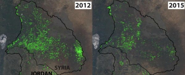
Using satellite imagery processed in the Google Earth Engine, a team from Stanford University in California was able to show how the country's reservoirs looked in 2012, just a few months after the war started, compared to 2015.
In the image below, you can see the coverage of irrigated agriculture (in green) in the region before and during the war, showing how markedly farming activity has dropped off:
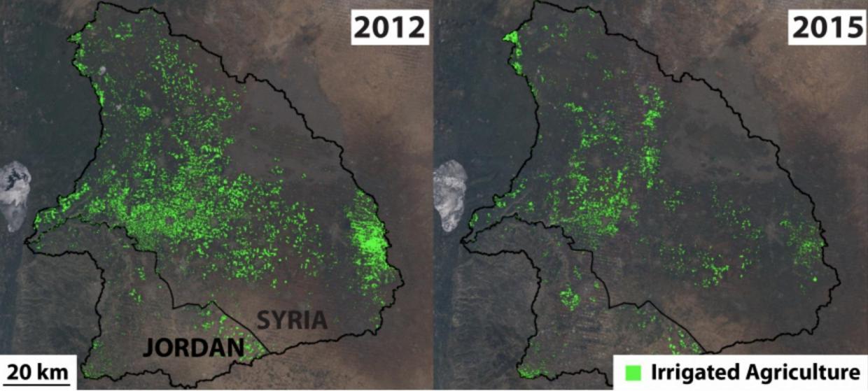
The researchers estimate that the amount of irrigated land has shrunk by 47 percent, and the water reservoirs have diminished by 49 percent.
"The water management practices in Syria have changed and that's visible from space," said one of the researchers, Steven Gorelick.
"The Syrian crisis has resulted in a reduction in agricultural land in southern Syria, a decline in Syrian demand for irrigation water and a dramatic change in the way the Syrians manage their reservoirs."
The team specifically looked at the 11 reservoirs in the Syrian-controlled Yarmouk-Jordan River basin, which provides crucial water supply for Syria, Israel and Jordan.
Many of these reservoirs have been intensely fought over during the conflict, and the water supplies that ended up under rebel control have often been badly managed, meaning they're being unsustainably drained of water.
To figure out what effect this has had, the team decided to use satellite images to get a bird's eye view.
"The big challenge for us was that it was going to be next to impossible to get on-the-ground data in Syria," said one of the research team, Jim Yoon.
They used images of land use on the Jordanian side of the Yarmouk basin as a control, to compared what the region looked like when not at war. And were able to show that reservoirs in Syria had been drained by 49 percent.
Before this, a a lot of research had been conducted into how climate change can lead to conflict, but this is one of the first studies to reliably show how conflict can cause environmental damage.
"It's the first time that we could do large-scale remote sensing analysis in a war zone to actually prove a causal relation between conflict and water resources," said lead researcher Marc Muller.
An interesting side effect of the reduced water usage and irrigation in Syria is that more than three times as much water is now flowing into Jordan from the Yarmouk basin compared to before the war.
That sounds like good news for the water-poor country, until you consider that more than 1.3 million Syrian refugees have fled to Jordan since the conflict, putting extra stress on the region.
"It's slightly good news for Jordan, but it's not a big bonus compared to what Jordan has had to give up and sacrifice for the refugees," said Gorelick.
"Even in terms of providing water for the refugees, this transboundary flow is not compensation."
In September, humanitarian groups expressed concerned over Syria's deteriorating water security, and warned that it could trigger disease and further migration.
The research has been published in Proceedings of the National Academy of Sciences.