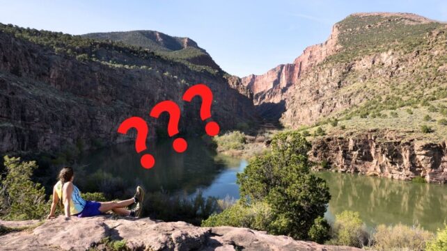
For more than a century, the Green River's course through the Uinta Mountains in Utah's northeast has been a geological mystery, seemingly defying physics.
Rivers carve their paths by flowing downhill across many years, which means they usually follow the slopes and furrows of any mountain ranges they encounter.
And yet the Green River, which has been following this course for just 8 million years, cuts right across the 50-million-year-old mountains to meet with the Colorado River, etching out the 700-meter (roughly 2,300-foot) deep Canyon of Lodor that runs perpendicular to the range (and all logic).
Geologist Adam Smith from the University of Glasgow in Scotland led a team to interrogate this long-held mystery. It turns out, the Green River did not have to flow uphill at all: instead, the mountain range was conveniently lowered, in a phenomenon known as lithospheric drip.
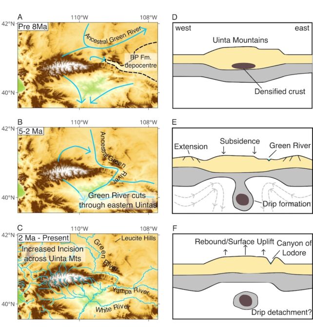
"Other rivers in the Uinta Mountains provide evidence that the height of the Uinta Mountains changed in the last few million years," Smith and team write.
Their data suggests the root of the Uinta Mountains, a dense mineral chunk at the base of the lithosphere, became so heavy that it 'dripped' into Earth's liquid mantle. This would have temporarily pulled the mountain range down, allowing the Green River to chart its unlikely course.
Later, the Uinta mountains grew by 400 meters up around the river, forming the canyon we have today.
 Seismic imaging involves reading the scatter of earthquake vibrations as they pass through Earth to create a picture of what's going on down there. At the Uinta Mountains, seismic images revealed a cold, round chunk about 200 kilometers below the surface: probably the drip in question.
What's more, the crust below these mountains is much thinner than you'd usually expect: more evidence that the drip had torn away the lower layers.
Related: Earth's Crust Is Dripping Under Midwest US, Scientists Discover
Once this drip broke free from the lithosphere about 2-5 million years ago, the mountain range was able to rebound. By then, the Green River had settled in for good: The Canyon of Lodor was there to stay, and the Green River became a tributary of the Colorado River.
"The merging of the Green and Colorado Rivers millions of years ago altered the continental divide of North America," Smith explains.
"It created the line that separates the rivers that flow into the Pacific from those that flow into the Atlantic, and created new habitat boundaries for wildlife that influenced their evolution."
The research is published in the Journal of Geophysical Research: Earth Surface.