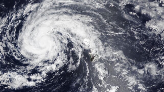
Of all recorded weather disasters, hurricanes cause the most catastrophic amounts of personal loss and infrastructure damage across the US.
Climatologically speaking, hurricanes and their accompanying seawater surges, strong winds, and lashing rainfall are inevitable on a world shaped by wind and water.
Or so it would seem. But this year has just set a storm record that may even seem propitious at first: zero hurricanes have formed in the Atlantic.
Recently, September 12th became the furthest into the year we have ever gone without a hurricane in the Atlantic basin since the advent of modern satellite tracking in 1966 – by a day.
Two hurricanes had previously formed on September 11th, both in the last quarter of a century: Hurricane Gustav in 2002 and Hurricane Humberto in 2013, notes Marshall Shepherd, a meteorologist and professor at the University of Georgia, writing for Forbes Magazine.
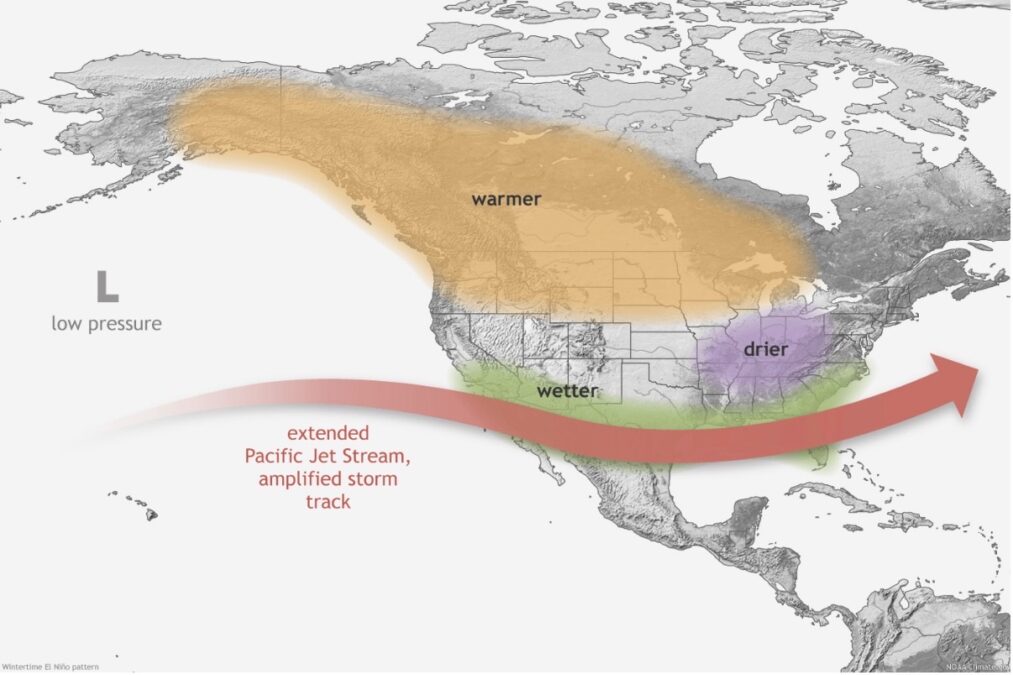
This development, or lack of thereof, hints at anomalous atmospheric action, as early September represents the climatological peak of hurricane season.
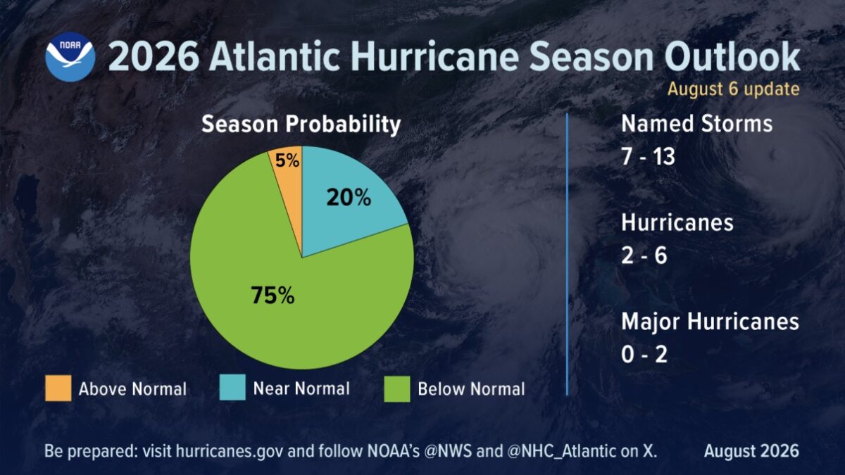
In August, the National Oceanic and Atmospheric Administration (NOAA) predicted a 75 percent chance that we'll experience a below-normal 2026 hurricane season in the Atlantic basin, which runs from June 1 to November 30.
For perspective, a normal Atlantic hurricane season yields 14 named storms, with wind speeds of 63 kilometers (39 miles) per hour or greater, seven of which become hurricanes attaining 119 kilometers (74 miles) per hour, including three major hurricanes with wind speeds of at least 179 kilometers (111 miles) per hour.
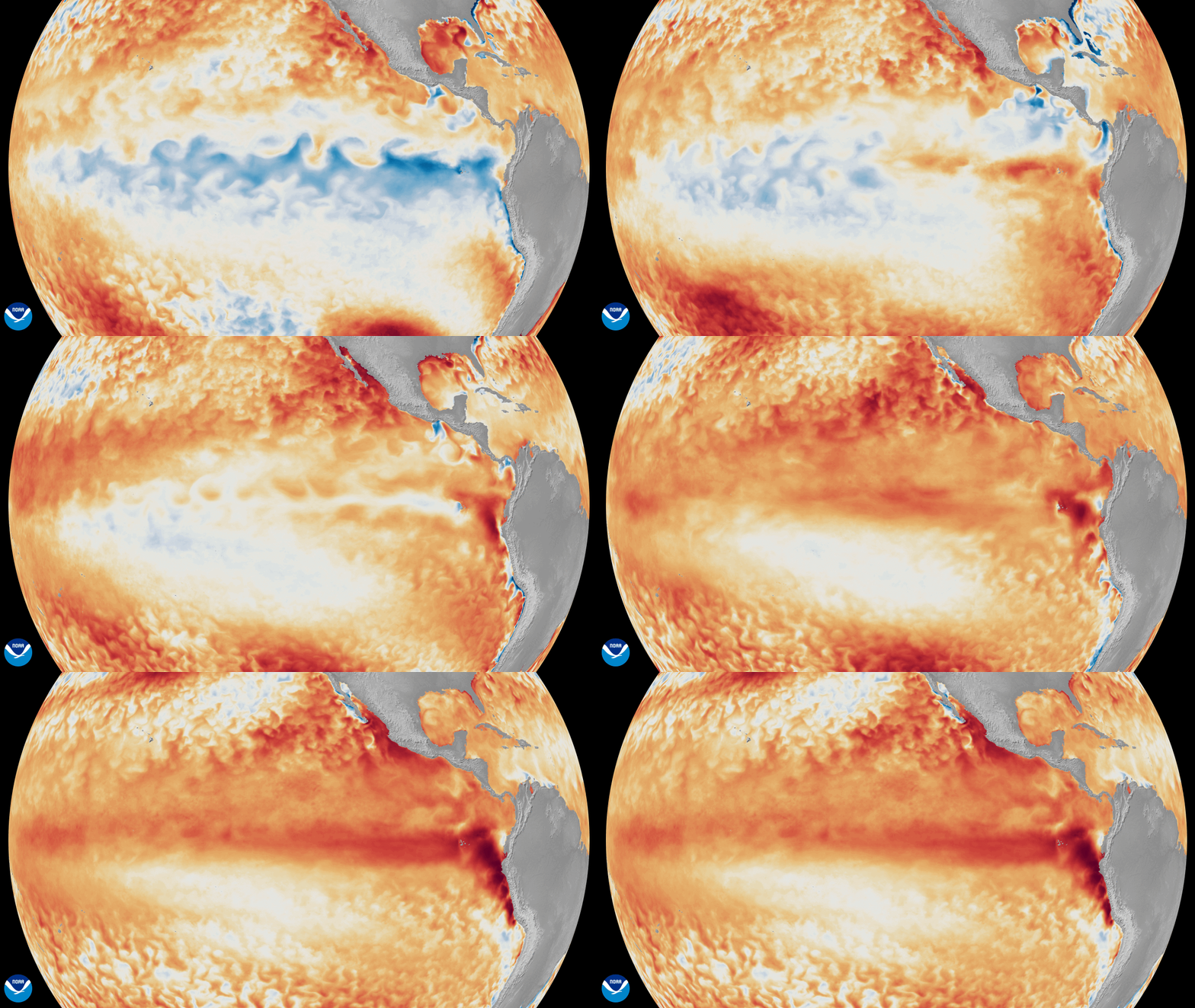
The curious quiet in the Atlantic owes to an exceptionally strong El Niño event this year, which began in the equatorial Pacific in June.
"El Niño is being supersized before our eyes," explains António Guterres, the Secretary-General of the United Nations.
"The science leaves no room for doubt: the planet is in uncharted waters, and those waters are heating up."
It may seem counterintuitive, but despite oceanic warming, El Niño has helped suppress storm formation in the Atlantic through wind shear, which shifts circulation patterns so that storms can't get started, or are prevented from growing stronger once they've formed.
"It's really staggering, just how inhospitable the Atlantic is to anything that could form a tropical cyclone right now," Kristen Corbosiero, Chair and Professor at the Department of Atmospheric and Environmental Sciences at the University at Albany told PBS News Hour.
Burgeoning storms are battered by a "triple whammy" of wind shear, dry air, and downward winds.
Altogether, these forces literally rip would-be-hurricanes apart, deprive them of moisture, and flatten them, Corbosiero explains.
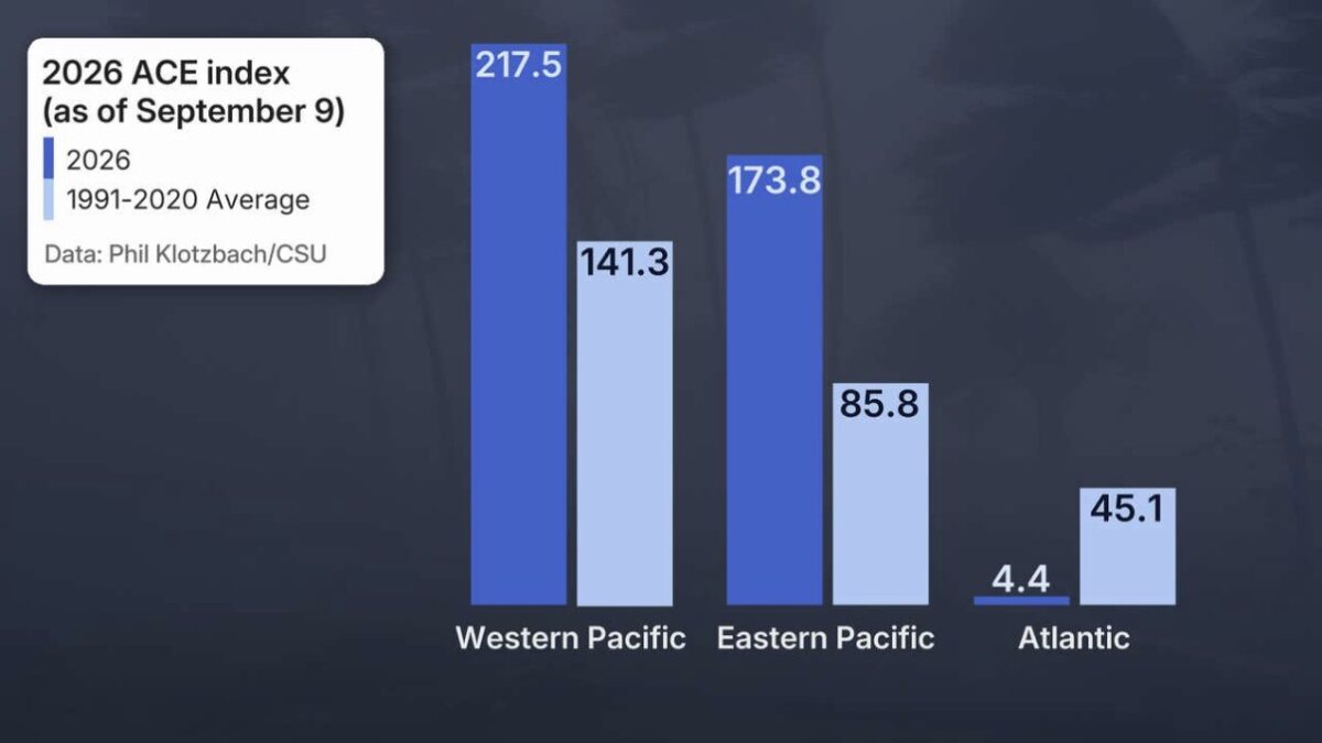
And though the Atlantic has seen five tropical storms this year, they've been relatively small. And Atlantic storm activity is around 7 percent of normal, entering peak stormy season.
These conditions have meanwhile generated an above-normal storm season in the Pacific, with 16 named storms in the eastern Pacific and 20 in the central Pacific, including six hurricanes, two of which hit Hawaii.
Other countries suffer from incendiary drought, as Indonesia's skies are darkened by an especially destructive, polluting wildfire season blazing through peatlands both on the surface and underground.
And if the current El Niño pattern is powerful, it's still strengthening.
"We are trending towards possibly the strongest El Niño on record as peaks usually happen during late fall or winter," Shepherd wrote in Forbes.
"While trying not to be too hyperbolic, I told one colleague at the University of Georgia that it could be the strongest El Niño that anyone alive has witnessed."
Overall, the World Meteorological Organization (WMO) forecasts that this intensifying El Niño will persist through February 2027.

Then, next season's Atlantic hurricane season may be "extra busy" as its waters continue warming, warns Kerry Emanuel, a professor of meteorology at MIT, noting that the Atlantic waters have not yet warmed as much as the air – and this thermal gradient is another factor in hurricane formation.
Related: Global Warming Is Breaking The Link Between Two Major Oceans
So, further forecasting and immediate humanitarian actions are necessary to mobilize life-saving information and support.
"El Niño does not have to be a recipe for disaster. We have the forecasts and foresight to save lives and protect livelihoods," concludes Celeste Saulo, the Secretary-General of the WMO.
"Let us join together and ensure that we leave nobody behind."
This article was fact-checked by Fiona MacDonald and edited by Fiona MacDonald. While we pride ourselves on our process, we are only human. If you spot a mistake, please let us know.