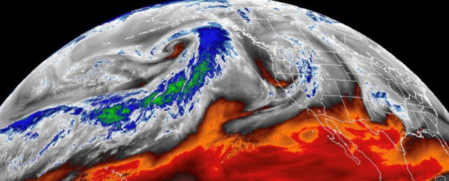
Rivers of intense moisture wend their way through our atmosphere just as their liquid counterparts do across the land. Unfortunately the sky streams are much harder for us to see.
Often a product of cyclones, atmospheric rivers can dictate where intense rain will fall, making their lack of visibility a problem. Understanding them grows increasingly important as our warming atmosphere soaks up even greater amounts of water, forcing these aerial waterways to change course.
Until now, researchers relied on computer modeling to predict where this water vapor likely flows, but researchers have now devised a way for us to spy on them in real time.
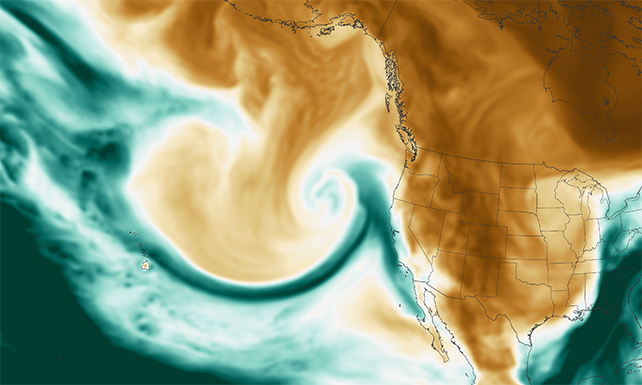
The missing piece of the puzzle was a 3D windscape.
University of California atmospheric scientist Weiming Ma and colleagues determined satellite records of spatial temperature distributions could be used to create an approximate real-time 3D wind field. Combining that data with NASA's satellite moisture detection revealed a global distribution of moisture-laden currents.
Most of the sky's moisture is transported across latitudes by atmospheric rivers as they flow polewards. They're responsible for up to 30 percent of annual precipitation in the US and Europe and as much as 40 percent in East Asia's wet season.
Atmospheric rivers typically form over tropical oceans, but when they hit the skies above land they often create weather hazards like damaging winds and flooding. As the jet stream over North America has shifted north over the last four decades, the atmospheric river frequency over the eastern US has increased.
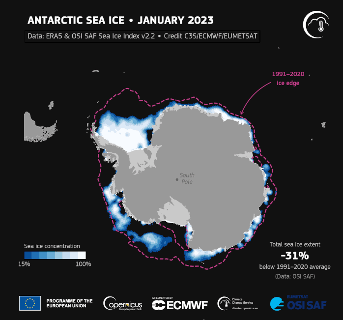
These sky rivers also influence sea ice variability – their presence increasing levels of melt. In the last few years sea ice has been reaching ever-diminishing record lows at both poles.
Analyzing the sky streams made visible, Ma and team can now see previous models had been overestimating the frequency of rain atmospheric rivers produced but underestimating the rain's intensity.
"As the quality of the satellite observations continues to improve, the methodology presented here can be applied to other satellite observations such as geostationary satellites to develop higher resolution or higher frequency atmospheric river statistics," Ma and colleagues explain in their paper.
Their new method can now be integrated into weather forecasts and climate models. The researchers plan to evaluate how climate models fare against their new method of atmospheric river detection next.
This research was published in the Journal of Geophysical Research: Atmospheres.