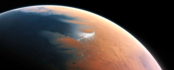
While many researchers agree that Mars, the now arid Red Planet, was once covered in bodies of water, there is little evidence of shorelines left on its surface. Surely, if there were oceans, there were coasts. So where did they all go?
Well, a new study suggests that these coastal markings are hard to spot because huge tsunamis destroyed them some 3.4 billion years ago.
According to the US-based team, which was led by Alexis Rodriguez from the Planetary Science Institute in Arizona, large meteor impacts sent tremendous waves across the Martian landscape billions of years ago. These waves had the power to wash away the geological markings that researchers typically associate with coastlines by covering them with sediment and debris.
These waves were of an unimaginable size, too. As Thomas Sumner reports for Science News, meteor impacts on Mars were strong enough to generate 120-metre (393-foot) waves, which could flood up to one million square kilometres (386,000 square miles) of area. That's about the combined size of Texas and California!
To make matters worse, these giant tsunamis probably happened roughly every 2.7 million years, based off of the rate the planet was struck with large meteors.
Using satellite data to examine displaced sediment on the Martian surface, the team was able to analyse two of these suspected tsunamis that happened roughly 3.4 billion years ago.
The first one was able to carry off huge boulders into weird areas where they do not belong on the surface. The second, which the satellite images suggest happened a few million years after the first, occurred after Mars' climate cooled. This means that it sent water flying into odd places where it then froze, creating strange formations.
Basically, the Martian landscape doesn't make a lot of sense to researchers because things are often out of place. There are boulders where there shouldn't be boulders and sediment is strewn all about. The team says tsunamis are the only way these characteristics could have formed.
"So, we think this is going to remove a lot of the uncertainty that surrounds the ocean hypothesis," Rodriguez told BBC's Jonathan Amos. "Features that have in the past been interpreted as relating to an ocean have been controversial; they can be explained by several, alternative processes. But the features we are describing - such as up-slope flows including large boulders - can only be explained in terms of tsunami waves."
Outside researchers seemingly agree with the team's findings because they're quite logical, though the only way to know more about them is to visit the areas pinpointed by the team, which isn't going to happen anytime soon.
"It's an important first step to try and identify these features from orbit, but looking at the structures up close would provide a more stringent test," MIT's Taylor Perron, a planetary scientist who was not involved in the new study, told Science News.
"Tsunami-related features along other parts of the ocean margin, and potentially other smaller former bodies of water, remain to be identified, mapped and studied in detail," Peter Grindrod, a planetary scientist from University College London who was also not a part of the new study, told BBC.
"However, this possible evidence of tsunami deposits is interesting and, along with other recent studies of widespread deltas, could perhaps mark the beginning of a reinvigoration of the ocean hypothesis."
Hopefully, the team will one day get the chance to explore the surface of Mars in person to add additional detail to their study. Until then, satellites will have to do.
The team's full report was recently published in the journal Scientific Reports.