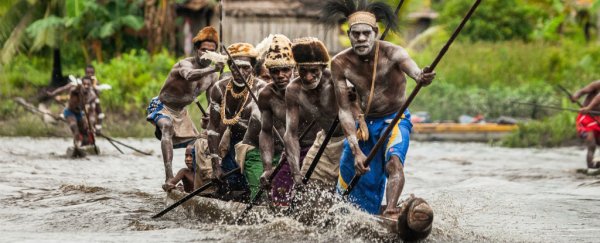
Researchers have shed new light on one of the mysteries of early human exploration: how ancient settlers managed to reach some of the world's most remote spots, without the help of planes, ships, or GPS devices.
The study focusses on a far-flung area of the Pacific called Remote Oceania, first populated by humans some 3,400 years ago, thanks to some of the most ambitious voyages our species has ever attempted.
By analysing climate data and running custom computer simulations, researchers have identified key routes to modern day Tonga, Samoa, Hawaii, Micronesia and Fiji, and mapped how these journeys were likely completed. And let's just say our ancestors knew a lot about their weather cycles.
"We synthesised a lot of new climatic data and ran a lot of new simulations that are exciting in terms of highlighting and pinpointing where some of these prehistoric populations might have come from," says one of the team, anthropologist Scott Fitzpatrick from the University of Oregon.
"The simulation can assess, at any point in time, if somebody left point A, where would they end up if they drifted? We can also model directed voyages. If somebody knew where they were going, how long would it take them to get there?"
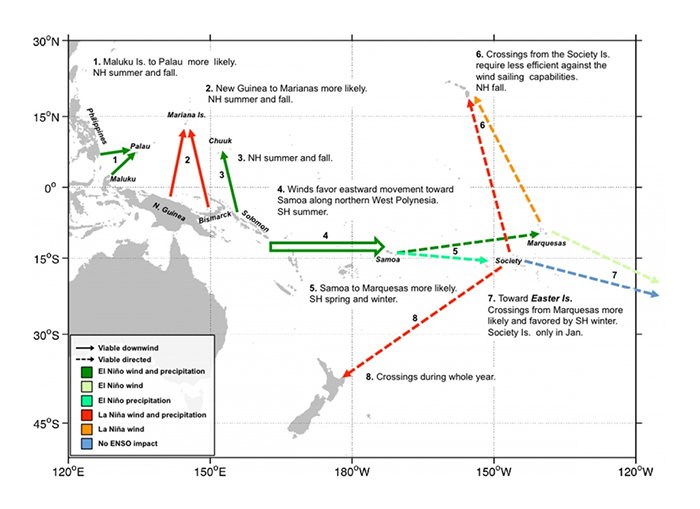 A map combining climatic data and computer simulations. Credit: University of Oregon
Fitzpatrick and his colleagues figred out the "shortest-hop" trajectories - where conditions would have been most favourable for a trip - and suggest that the El Niño-Southern Oscillation shifts in wind and warm air might have played a role.
They say settlers could have timed their voyages to match up with El Niño periods (every three to seven years) when winds and ocean currents made their trips easier.
The models included new high-resolution satellite imagery, plus a wealth of data covering archaeological records, weather logs, and changes in sea levels.
Like a complex, ocean-based game of The Sims, the computer models revealed how small boats might have travelled such large distances - up to 2,500 miles (4,023 kilometres), in some cases.
The simulations also provide an explanation for what's known as 'the long pause' - a period of more than a millennium starting from roughly 1000 BC, where humans seemed to be much less adventurous in the region than they were before.
According to the researchers, strong winds - plus a lack of technology needed to work around them - could have been the reason for this prolonged period of staying on shore.
"What Pacific scholars have long surmised but never really been able to establish very well is that, through time, Pacific Islanders should have developed a great deal of knowledge of different climatic variations, different oscillations of wind, and changes in environments that would have influenced their survivability and their abilities to go to certain places," says Fitzpatrick.
The team also charted possible starting-off points. Samoa was the most likely staging area for colonising East Polynesia, they suggest, while settlers on Hawaii and New Zealand may well have come from the Marquesas Islands or Society Islands.
What's less certain is why these brave sailors set out on trips of between 400 and 2,500 miles in the first place. Was it a need for more resources? Or a feeling of adventure?
"What drove the movement? That's the big question," says Fitzpatrick. "Was it political? Was it a result of population pressure? There were probably multiple reasons why people decided to leave one place and go to another."
The research has been published in PNAS.