
It probably comes as no surprise to people living in low-lying coastal regions, but sea waters are rising by large, measurable amounts. That assessment comes from NASA, which has analyzed 30 years of sea-level satellite measurements.
The news is not good. Since 1993, the seas rose by a total of 9.1 centimeters. Two years ago, it went up by 0.27 centimeters. That one-year rise from 2021 to 2022 may sound small by comparison, but it's a harbinger.
And, it adds up over time.
Even taking into account slight shifts due to natural influences like La Niña (which periodically cools the oceans), sea heights continue to rise. Based on continued long-term satellite measurements, the projected rate of sea level rise will hit 0.66 centimeters per year by 2050.
To bring that idea home, last year NASA estimated that levels along the US coastlines could rise as much as 30 centimeters above where they are today by 2050. It could get worse in other parts of the world.
We're Causing This Sea Level Rise
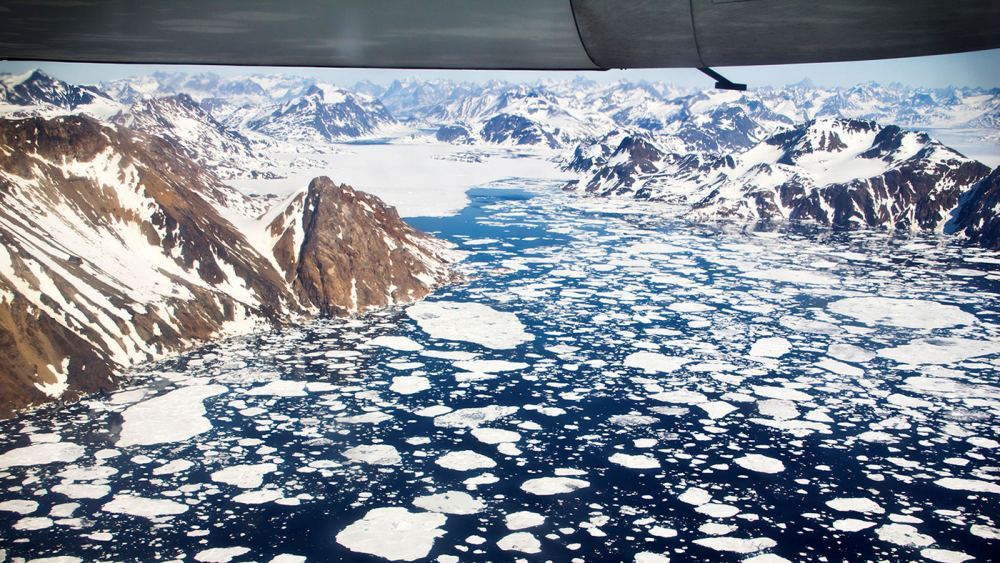
The culprit for all this is human-caused climate change. It's driven by the excess amounts of greenhouse gases like carbon dioxide that humans pump into the atmosphere. Climate change has a number of effects across the globe, but it's particularly obvious in Earth's ice sheets and glaciers.
Just this past year alone, the Antarctic ice sheet has experienced above-average melting, even accounting for summer temperatures.
The stability of Greenland's ice pack has changed a great deal, and today the Greenland Ice Sheet is a major contributor to sea level rise. That's because its runoff and water from the Antarctic ice add more fresh water to the ocean while warming causes the expansion of seawater. The result is rising seas which override other natural effects on sea surface height.
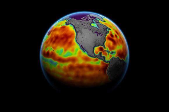
Tracking Sea Height from Space
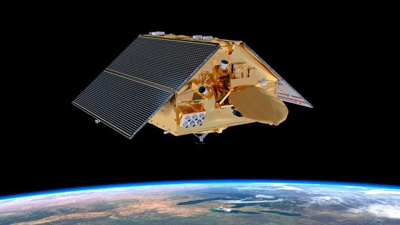
The best and most accurate way to track ocean height rise is with space-borne instruments on satellites.
The US-French TOPEX/Poseidon mission began measuring sea surface height in 1993. Since then, sea-level observations continued through missions led by NASA, ESA, and the US National Oceanic and Atmospheric Administration (NOAA).
Scientific and technical innovations such as radar altimeters help produce ever-more precise measurements of sea levels around the world. To calculate the sea height, they bounce microwave signals off the ocean's surface. Then, they record the time the signal takes to travel from a satellite to Earth and back, as well as the strength of the return signal.
"We have this clear view of recent sea level rise – and can better project how much and how quickly the oceans will continue to rise – because NASA and Centre National d'Études Spatiales (CNES) have gathered decades of ocean observations.
"By combining that data with measurements from the rest of the NASA fleet, we can also understand why the ocean is rising," said Karen St. Germain, director of NASA's Earth Science Division in Washington.
The 30-year satellite record not only shows long-term trends but allows scientists to see through naturally occurring shorter-term shifts.
"That helps us identify the trends that tell us where sea level is headed," said JPL's Ben Hamlington, a researcher who leads NASA's Sea Level Change science team.
These measurements are coupled with nearly a century of land-based observations and long-term measurements of greenhouse gases in the atmosphere. Data from ice mass and land motion measurements give scientists a better idea of how and why seas are rising.
Ground-Level Effects of Sea-Level Rise
All these fundamental observations are important to understand the effects of climate change. But, they also help shape the types of services that federal and international agencies offer to coastal communities. These are the front-line places that have to prepare for rising waters.
As this rise continues, at least 800 million people will be facing at least a half-meter rise in water levels. In practical terms, that places such as Miami, New York, Bangkok, Shanghai, Lima (Peru), Cape Town, and many others, will suffer continual seawater incursions.
Coastal regions in the US alone are home to more than half the country's population. They contain major shipping ports, as well as recreational areas, and other facilities. The major physical impacts of sea level rise also threaten wildlife populations, delta regions, marshes and wetlands.
These are just a few effects of climate change and how it is pushing sea levels up. That's why fleets of satellites are not only tracking the rise of seawater, but the atmospheric concentrations of gases like carbon dioxide.
"Tracking the greenhouse gases that we add to the atmosphere tells us how hard we're pushing the climate, but sea levels show us how much it's responding," said Josh Willis, an oceanographer at NASA's Jet Propulsion Laboratory in Southern California.
"These measurements are a critical yardstick for how much humans are reshaping the climate."
This article was originally published by Universe Today. Read the original article.