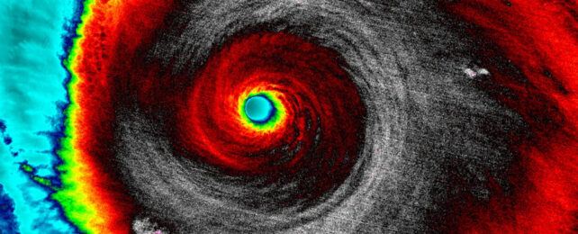
Heat trapped by fossil fuel emissions is making Earth's atmosphere 'huff and puff' with increasing fury. Some winds are now blowing so intensely that researchers propose adding an even more extreme category to the Saffir-Simpson Hurricane Wind Scale.
"As a cautious scientist, you never want to cry wolf," Lawrence Berkeley National Laboratory climate scientist Michael Wehner told Dinah Voyles Pulver at USA Today. But "the wolf is here."
The scale the US has been using since the early 1970s extends from Category 1 indicating an irritating 120 kilometers (74 miles) per hour of winds, to a harrowing 250 kph (157 mph) or greater for Category 5.
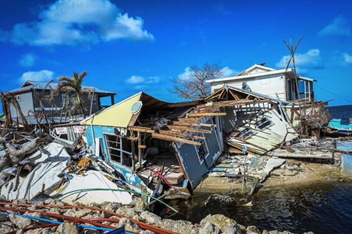
Winds this powerful can demolish houses and destroy infrastructure, leaving areas uninhabitable for weeks if not months. But 252 kph no longer captures the extent to which these storms can now blow, Wehner and former climate scientist James Kossin argue.
"Because climate change increases temperature and moisture – which are the sources of the energy for a hurricane or a tropical cyclone – one would expect this speed limit to increase," Wehner explained to Li Cohen at CBS News. "And indeed it does."
From 1980 to 2021 there has been an increase in storms well beyond Category 5's baseline. So the researchers propose extending the classification system to include Category 6 which would encompass hurricanes with winds racing at nearly 310 kph (192 mph) or more.
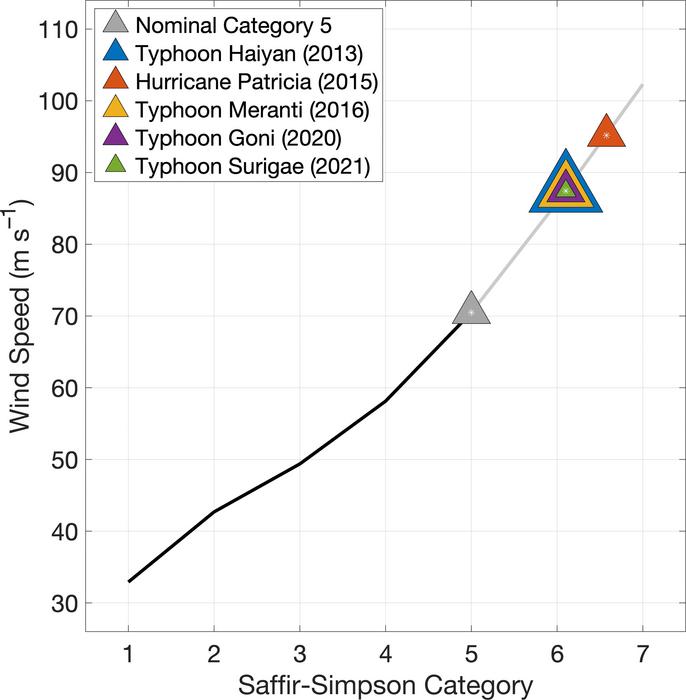
At least five storms since 1980 would fall into that category, and all of them have occurred in just the last 9 years.
This includes on of the most powerful tropical storms recorded yet, Typhoon Haiyan. In November 2013 this storm belted the Philippines with 315 kph winds, leaving in excess of 4 million people homeless and killing more than 6,300.
The team's modeling suggests the Gulf of Mexico would experience a doubling of Category 6 storms at around 2 °C of global warming above pre-industrial levels, and regions near the Philippines can expect an increase of about 50 percent.
The current scale is inadequate, the team argues in their paper. At 346 kph, Hurricane Patricia – which hit Mexico in 2015 – was 97 kph faster than the lower limit of Category 5.
"[The existing scale] is problematic in the context of communicating expected increases in peak tropical cyclone wind speeds under climate change," agrees University of Otago hydroclimatologist Daniel Kingston, who was not involved in the study.
Kingston explains that although other regions, like New Zealand, may not experience the full brunt of cyclones directly, remnants of the storms can still cause far reaching devastation, such as the flooding occurring right now down Australia's east coast after a cyclone in the north.
"The "most common, and widespread impacts from any tropical cyclone is water damage, from rain and storm surge," notes Raveen Das, manager of New Zealand's Tropical Cyclone Warning Centre. Other researchers agree wind speed isn't the best reflection of these storms' impacts, let alone the only measure of its destruction.
While other regions use different cyclone scales they are also based on winds speeds and have the similar open-ended upper limits, so meteorologists globally are watching this discussion with interest.
"While adding a 6th category to the Saffir–Simpson Hurricane Wind Scale would not solve [the issue of storm surge risk], it could raise awareness about the perils of the increased risk of major TCs due to global warming," Wehner and Kosiin conclude.
Their research was published in PNAS.