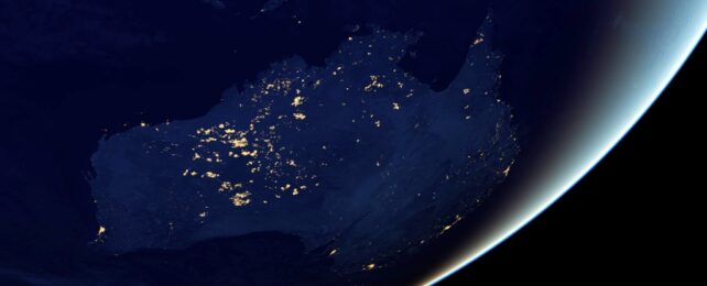
Between 75,000 and 50,000 years ago, humans began to make their way across the megacontinent of Sahul, a landmass that connected what is now Australia, Tasmania, New Guinea, and the Aru Islands.
New research reveals more about the routes used by these early humans and the length of time it took for them to fully explore the extremities of Sahul. It could have taken up to 10,000 years for the vast area to be completely covered by these intrepid humans, which is twice as long as previously thought.
To refine their estimates, researchers developed a new, more sophisticated model that factored in influences on travel, like the land's ability to provide food, water source distribution, and the landscape's topography.
"The ways that people interact with terrain, ecology, and potentially other people alter our model outcomes, providing more realistic results," says ecologist Corey Bradshaw from Flinders University in Australia.
"We now have a good prediction of the patterns and processes of how people first settled these lands tens of thousands of years ago."
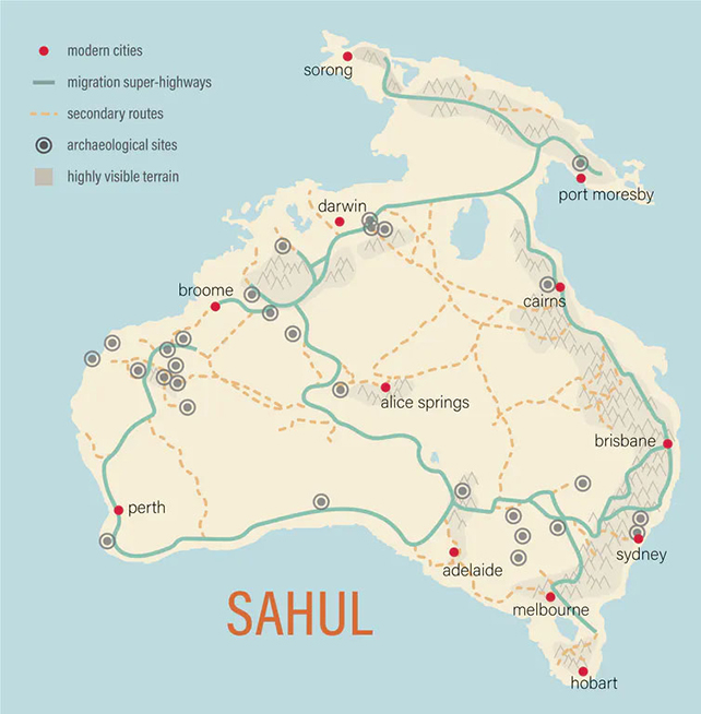
The researchers combined the data from two previously published studies, one that modeled patterns of population movement and growth via a grid-based system and one that charted the probable 'superhighways' of exploration based on landscape features.
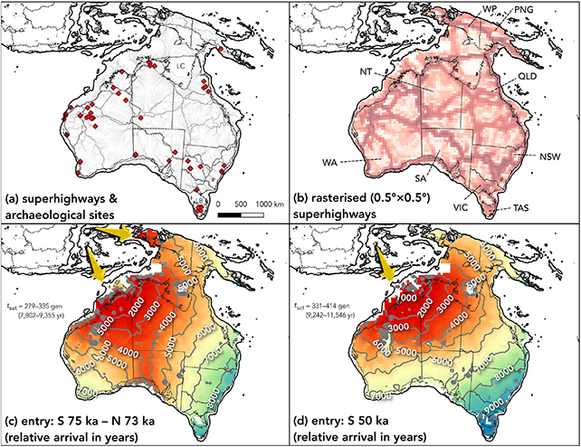
As well as extending the prediction for the time it took to settle the megacontinent due to restrictions imposed by the topography, the new model also identified an undetected new corridor of movement southwards through the center of Sahul.
"A person walking on the landscape and choosing that basic path repeatedly would likely lead to migration corridors because individuals pass on the knowledge of the landscape over time to the rest of the population," the researchers write in their published paper.
Migration most likely began through Timor, then later through western parts of New Guinea. Rapid expansion would then have happened southward toward the Great Australian Bight and northward to New Guinea.
The researchers also suggest that trips to Tasmania would have been restricted by the rise and fall of sea levels in the Bass Strait – an example of how the new model factors in the influence of the landscape on population spread.
"Our updated modeling shows that New Guinea was populated gradually over 5,000 to 6,000 years, with a focus initially on the Central Highlands and Arafura Sea area before reaching the Bismarck Archipelago in the east," says Bradshaw.
"The peopling of the far southeast and Tasmania is predicted to have occurred between 9,000 and 10,000 years following initial arrival in Sahul."
The researchers think that their findings could apply to other parts of the world when it comes to mapping how Homo sapiens made their way out of Africa, through Asia, and into the Americas, though the models would have to be adapted to suit different regions.
These predictions could then be backed up and verified using finds from archaeological digs, which was the case in this particular study.
Whether it's preferring a route through two mountains rather than over them or keeping close to water sources, these details can be significant when it comes to where populations spread and how quickly.
"This also goes to show the power of combining computational models with archaeology and anthropology for refining our understanding of humanity," says archaeologist Stefani Crabtree from Utah State University.
The research has been published in Quaternary Science Reviews.