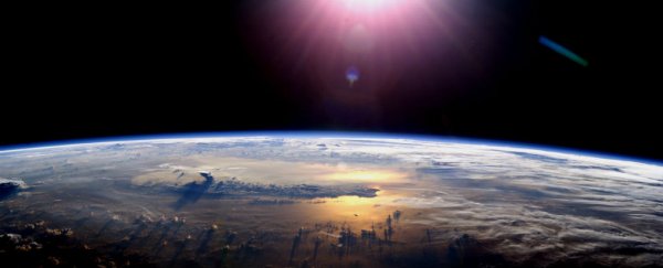
You might be used to peering down at your street on Google Maps, but what if those satellite photographs were completely up to date – maybe even just a few hours old?
That's the plan of Japanese imaging company Axelspace, which is launching 50 new satellites to take on the huge task of capturing an Earth selfie every 24 hours. They hope the new technology will find use in everything from tracking crop growth to checking long-distance pipelines.
The beauty of this regularly updated world map – which Axelspace plans to share with other companies – is that it becomes much easier to track forest, iceberg, desert, or urban sprawl changes over time. The possibilities are almost limitless.
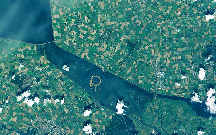
"AxelGlobe is the Earth observation infrastructure for a new era," explains the Axelspace site. "It will have the ability to image the whole civilised world with a resolution of 2.5 metres [8.2 feet] – enough to distinguish cars – every day."

That means it's not sharp enough to track your movements, but sharp enough to tell where you've parked (and maybe monitor parking patterns at the shopping mall even).
The company is using proprietary microsatellites called GRUSs, which weigh about 95 kilograms (209 pounds) each and are much cheaper than conventional imaging satellites. Each GRUS will cover around 850,000 square kilometres (328,187 square miles) each day.
As Juan Buis reports at The Next Web, they're also designed to crash safely back to earth after 25 to 30 years, to avoid a further buildup of space debris.
If all goes to plan, we won't need to wait long until these data feeds are available, either: the first pictures should start coming through in 2018, with the whole network up and running by 2022, according to Axelspace.
 Credit: Axelspace
Part of what sets this apart from existing satellite mapping systems is that it's going to have an Application Programming Interface (API) to allow other services and apps to plug into it. APIs let different systems talk to each other properly – if you load up Twitter in an app that's not made by Twitter, that's the Twitter API at work.
So whether you're a charity wanting to check the scale of a natural disaster or a research base monitoring ice shelf movements, Axelspace should be able to help.
Right now, the likes of Google, Apple, and Microsoft source imagery in their maps from a range of partners and satellites, including the latest WorldView-3 system. This commercial network is much bigger than the Axelspace satellites and capable of spotting objects as small as 31 centimetres (12 inches) in size, but it's also more expensive to operate and access.
If you access a conventional satellite image on your smartphone, how dated it is will depend on where in the world you are. Some parts of the globe don't have any high-resolution imagery available at all, while in other places the pictures are refreshed about once every three years.
Axelspace aims to dramatically improve that refresh rate, and help us learn more about our planet at the same time. We can't wait to see what these microsatellites come up with.