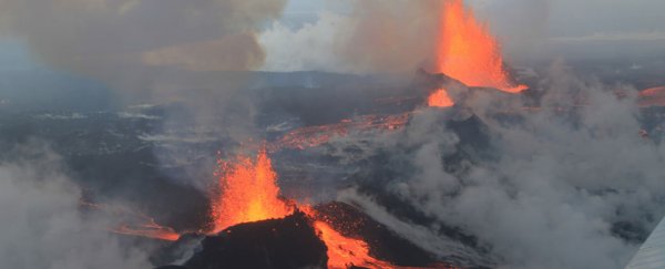

Scientists have used the seismic data of 273 strong earthquakes over the past 20 years to create a high-resolution 3D map that shows how plumes of hot rock stretch from Earth's mantle to volcanic hotspots like Hawaii and Samoa.
Likening their technique to a CT scan of Earth's interior, seismologists from the University of California, Berkeley in the US say their new 3D model offers the first accurate glimpse at the gargantuan hot rock formations that lie underneath volcanoes.
"No one has seen before these stark columnar objects that are contiguous all the way from the bottom of the mantle to the upper part of the mantle," said Scott French, first author of the study, in a press release.
Earth's mantle is an interior layer of rock that lies in between the planet's outer core and its surface crust. The mantle is nearly 3,000 km thick, and the researchers' 3D scan shows for the first time how these super-hot columns of rock (400 degrees Celsius hotter than surrounding rock) extend throughout the majority of it.
These plumes are massive too. At depths of about 1,000 km, they range between 600 and 1,000 kilometres in width, which is up to five times wider than geophysicists had previously thought.
They don't quite make it all the way to the top of the mantle, however. At about 1,000 km deep, they fan out like a river delta spreading upwards, with thinner streams connecting to Earth's volcanoes and generating island chains. It's a good thing this happens too – if the plumes didn't spread out, Earth wouldn't be a very nice place, with massive volcanoes gaping hundreds of kilometres wide.
"These columns are clearly separated in the lower mantle and they go all the way up to about 1,000 kilometres below the surface, but then they start to thin out in the upper part of the mantle, and they meander and deflect," said senior author of the study, Barbara Romanowicz. "So while the tops of the plumes are associated with hotspot volcanoes, they are not always vertically under them."
 Credit: University of California, Berkeley
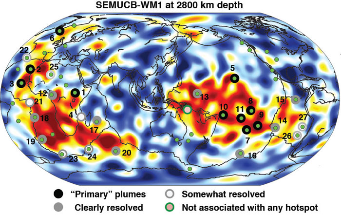
Perhaps even more amazingly, the 3D scan indicates that the bases of the plumes are anchored at the core-mantle in two giant chunks of hot rock, each measuring approximately 5,000 km in diameter. These blobs, the locations of which you can see in the image above, are thought to have been in the same spots for 250 million years.
The findings, which are published in Nature, required the equivalent of 3 million hours of data calculations based on seismic wave recordings. The work was done by supercomputers at the US National Energy Research Scientific Computing Centre, which used parallel computing to reduce the workload down to a more manageable three weeks.