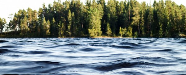
Waves rippling across a lake can also cause faint rumblings in Earth itself, according to scientists, giving us clues about the condition of a lake and its surrounding geology through the readings of a seismometer.
For instance, scientists could be able to tell whether a lake was frozen over without direct observations, just from the seismic readings in the surrounding area.
These seismic shudders wouldn't be strong enough to feel if you were standing there on the ground. But with the right instruments they could allow us to map climate change and take other readings across wide areas, suggest the researchers from the University of Utah and Yunnan University in China.
"It's kind of a new phenomenon," says one of the researchers, Keith Koper from the University of Utah. "We don't really know how it's created."
Small bursts of seismic activity, called microseisms, are already known to form from ocean waves dragging across the sea floor – they're part of the background seismic noise observed in coastal locations.
Studying waves from lakes in this way is a newer idea, and the researchers used data from earlier studies alongside new readings from Yellowstone Lake in Wyoming as well as Dianchi Lake, Fuxian Lake, and Erhai Lake in China.
"The lakes span more than two orders of magnitude in size (areas from 210 km2 to 27,000 km2) and sample a range of climatic and tectonic regimes in Canada, the US, and China," the researchers write in their study.
What they found was that by averaging seismic activity over longer periods, like six months or so, it's possible to create what the scientists call a "CT scan of the Earth".
These small seismic waves travel through different geological materials at different speeds, enabling scientists to work out the composition of the ground around a lake – and without the need for an artificial shock like an explosion or vibrating plates.
"It would take quite a bit of effort and work to generate this level of energy [artificially]," says Koper.
The study found that these lake microseisms could act as accurate predictors of how an earthquake might affect an area, as well as picking up on whether or not a lake was frozen over, which affects the speed of the ripples.
Rather than satellite readings or field trips, scientists could use autonomous seismometers to check the changes in seasonal temperatures around a lake. When the known freezing and thawing times for Yellowstone Lake were compared to interpretations of the seismic data, everything matched up.
For remote lakes high above sea level, which are useful indicators of our changing climate, that sort of automatic monitoring could prove very helpful.
The next step in the research is to understand exactly how ripples on a lake lead to ripples underground, and to do that more data and more instruments are going to be required.
"If we can record at the same time on land and underwater, we can get a better idea of how these things are generated," says Koper.
The findings have been published in the Journal of Geophysical Research Solid Earth.