You're probably familiar with the legend of Atlantis - the allegorical city dreamt up by Plato that was lost to the sea - but have you heard of the very real British town of Dunwich?
Yep, there's a submerged city off the coast of the UK, which has been sinking since the 1200s. In some areas, the town of Dunwich has sunk up to 10 metres under the North Sea.
So how did this happen? The story of Dunwich has to do with coastal erosion - a natural process where waves slowly eat away at dune sediment, eventually creating a new shoreline.
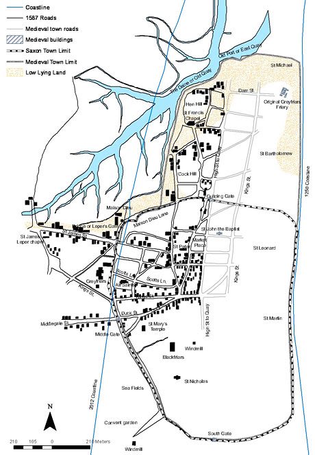
If you were to hop into a time machine and teleport back, you'd find Dunwich to be the booming capital of East Anglia with a harbour that rivalled London's in traffic. It also had a coastline 2,000 metres (6,562 feet) further out than if you were to visit the area today.
The coast first started eroding on New Year's Eve back in 1286, when a series of storms hit the town, blocking off the mouth of the nearby Dunwich River with sediment, and creating a perpetual flood.
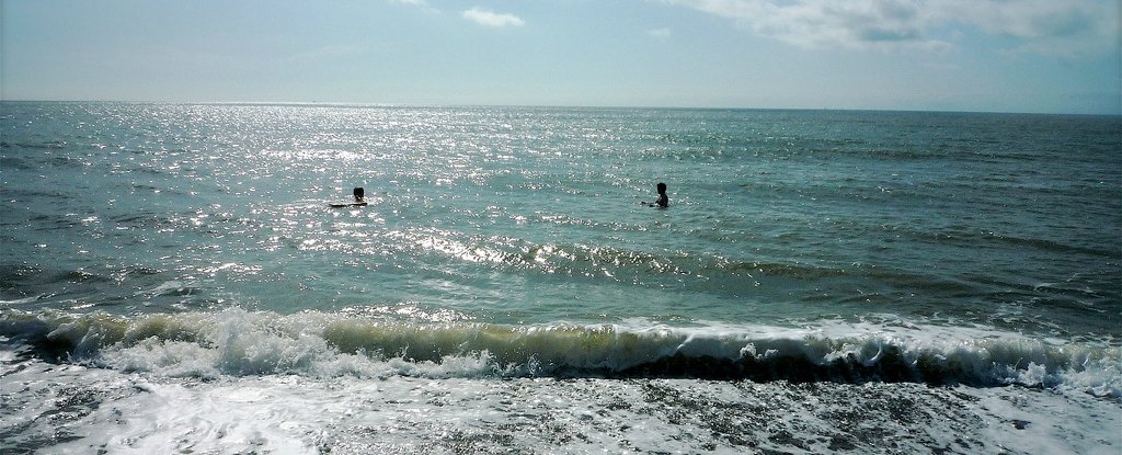
Over time, the water continued to rise, eventually putting the entire town under 3 to 10 metres (9.8 to 33 feet) of water. Nowadays, the remaining town contains only a handful of streets, a museum, and a pub. The rest is hidden under the waves.
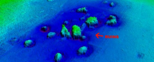
Despite the medieval section of the town lying under a just few metres of water, researchers have had a tough time studying it, thanks to low visibility.
But the good news is that, back in 2013, a team of researchers from Southampton University were able to make an accurate map of the lost town using acoustic mapping.
"Visibility under the water at Dunwich is very poor due to the muddy water. This has limited the exploration of the site," said team leader David Sear.
"We have now dived on the site using high-resolution DIDSON acoustic imaging to examine the ruins on the seabed - a first use of this technology for non-wreck marine archaeology. DIDSON technology is rather like shining a torch onto the seabed, only using sound instead of light."
Using this technology, the team was able to come up with a detailed map, which shows how the city would have looked in its prime:
 Southampton University
While it's awesome to learn more about the archaeology of lost towns, Dunwich in particular reveals coastal change has affected humanity long before modern day global warming.
"Global climate change has made coastal erosion a topical issue in the 21st century, but Dunwich demonstrates that it has happened before," Sear explains.
"The severe storms of the 13th and 14th centuries coincided with a period of climate change, turning the warmer medieval climatic optimum into what we call the Little Ice Age."
Understanding how this happens is vitally important, especially given that today's rising oceans affect nearly half of the world's population living on or near coasts.
It also offers a chance to see how the citizens would have coped with the changes over time. For Dunwich in particular, it seems that the events triggered a series of economic decisions that eventually led to people abandoning the city.
"Our coastlines have always been changing, and communities have struggled to live with this change. Dunwich reminds us that it is not only the big storms and their frequency - coming one after another, that drives erosion and flooding, but also the social and economic decisions communities make at the coast.
In the end, with the harbour silting up, the town partly destroyed, and falling market incomes, many people simply gave up on Dunwich."
Hopefully, as researchers like Sear and his time continue to explore, map, and study towns like Dunwich, we will learn more about the populations that used to live there, giving us a better understanding of how to handle similar situations in modern times.
The Southampton University team's work was published in The International Journal of Nautical Archaeology.