
A towering thundershower shot up off the coast of Gulf Shores, Alabama, on 17 July 2016. Rick Geiss was sitting on the beach in front of his condominium at Crystal Shores West when he snapped a photo with his iPhone.
This week, he shared it with meteorologist Jacob Dunne of the Mobile NBC affiliate, who posted it to Twitter, calling it "quite possibly the best example of a mushroom cloud I have ever seen."
The photo has gone viral, wowing weather enthusiasts on social media.
Brian Stelter, host of CNN's Reliable Sources, called it "incredible."
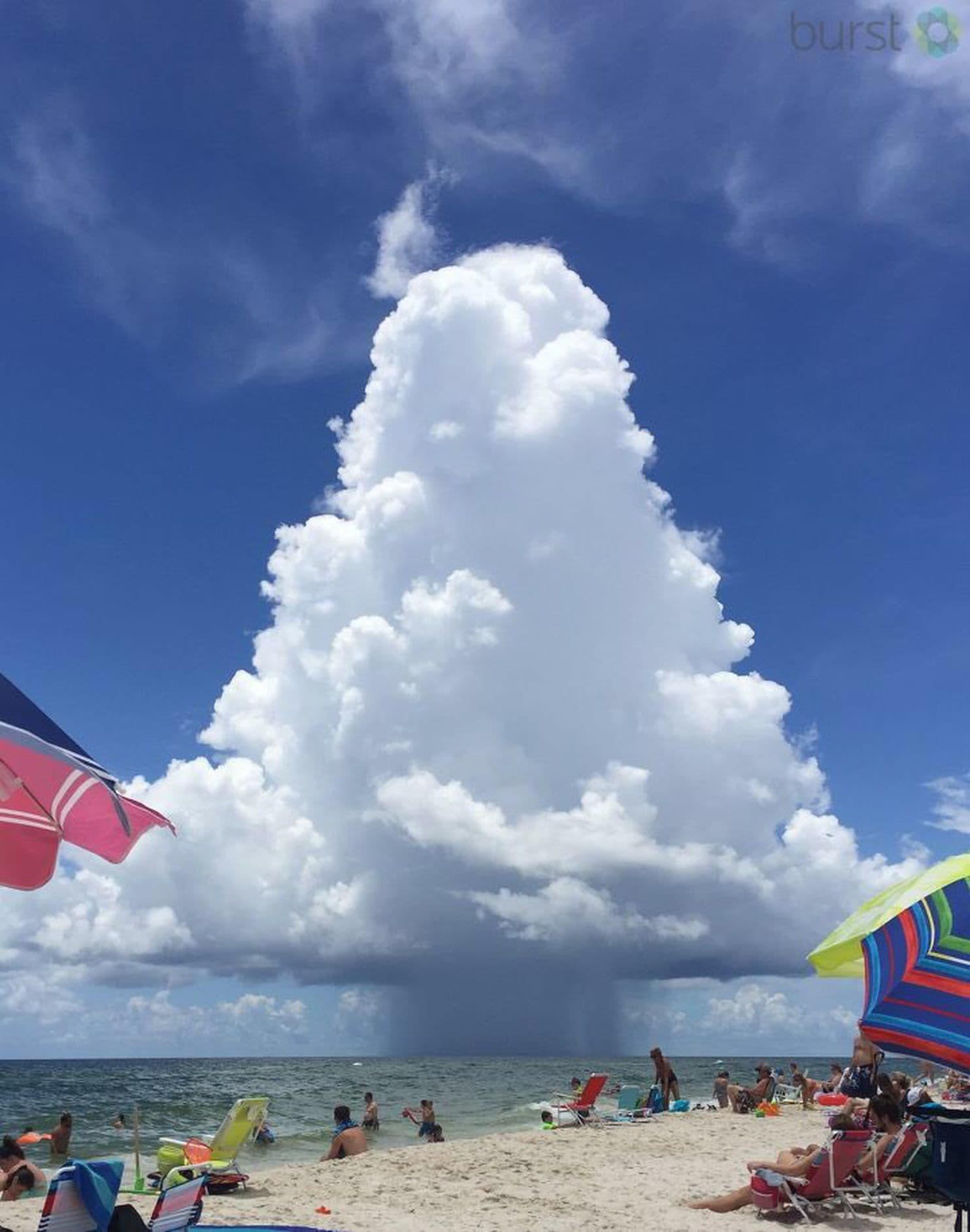 The epically towering thundershower, 17 July 2016 (Rick Geiss)
The contrast between the white billowing clouds and dark, menacing rain shaft is stunning. And the cloud-form is so symmetrical that some have questioned the photograph's authenticity.
But our verdict is that this is the real deal.
"The picture portrays a solitary, tall convective cloud called a cumulus congestus which is basically Latin for 'tall, heaped up cloud'," said Jeff Halverson, Capital Weather Gang's severe weather expert.
"There is a large, central updraft (buoyant plume of air) that shapes the overall cloud. The tapered appearance probably occurs because drier, cooler air is being pulled inward, and upward, along the margins of the updraft … evaporating some of the cloud edges and 'sculpting' its unique shape."
The photo presents a textbook example of what are known as pulse, pop-up or air mass thundershowers.
They form in the absence of a large-scale thunderstorm trigger such as a cold front, and are simply fueled by the Sun's energy on hot, lazy summer days.
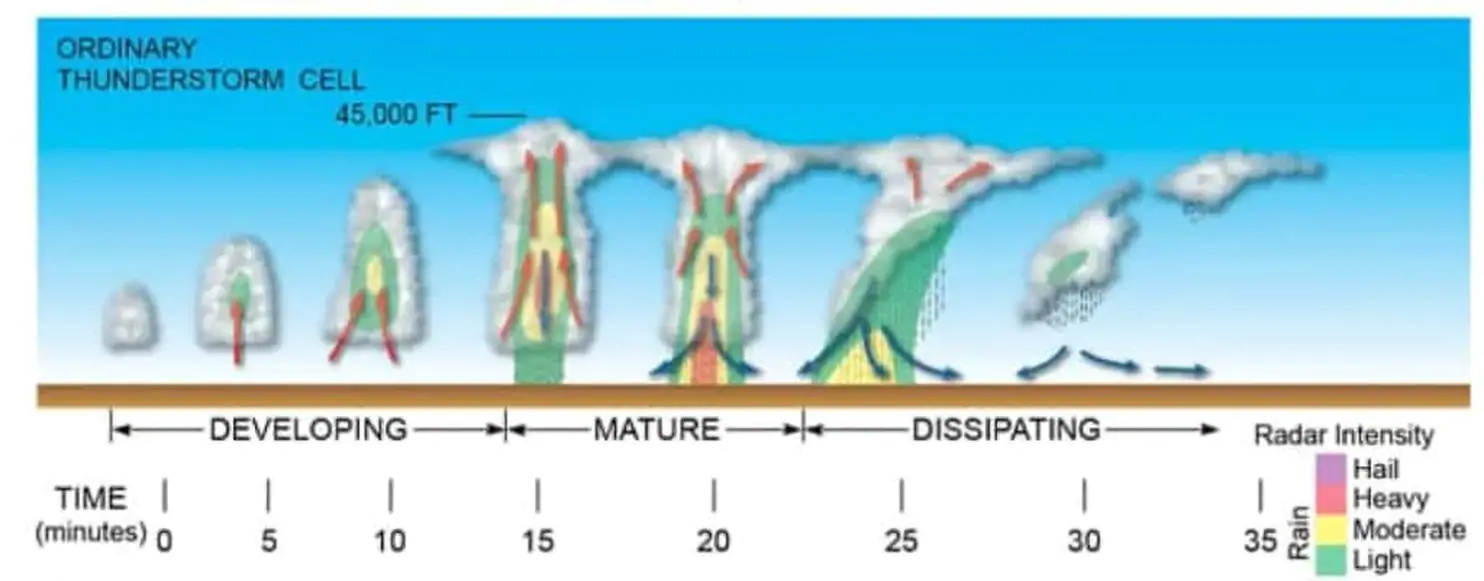
In an article published in 2013, Halverson described how these "pulse" storms evolve:
"A buoyant plume or bubble of rapidly rising air - the updraft - ascends during the first 15 minutes of the storm. Large amounts of water vapor are drawn inward and upward, condensing into a mass of rain.
"After 15-20 minutes, the rain falls out. The drag of the descending rain mass creates the downdraft, which is further enhanced by evaporative cooling (evaporation chills the air, increasing its density).
"As the downdraft plummets straight down through the updraft, it snuffs out its buoyancy. Without a self-sustaining updraft, the storm's final minutes are literally spent raining itself out."
 The life cycle of a mushroom cloud (Thomas Rabenhorst, UMBC)
Their evolution is nicely illustrated in the above diagram. The so-called "mushroom cloud" photo mimics what's shown for a pulse storm's mature phase.
These kinds of storms usually last 30 minutes or less because of a lack of wind shear, or increasing wind speed with altitude. This causes their updrafts to be vertical, pointing straight up into the sky, rather than tilted.
As a result, the rain-cooled air from the storms' downdrafts pass through the same column of air as the updrafts, eventually causing the updrafts to collapse. When wind shear is present and the updrafts are tilted and separated from the downdrafts, the storms can last longer and potentially intensify.
2018 © The Washington Post
This article was originally published by The Washington Post.