The Great Salt Lake is so named because of the salinity of its water, but a new study appears to have detected a huge reservoir of salt-free freshwater hiding underneath it.
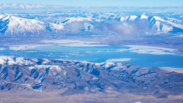
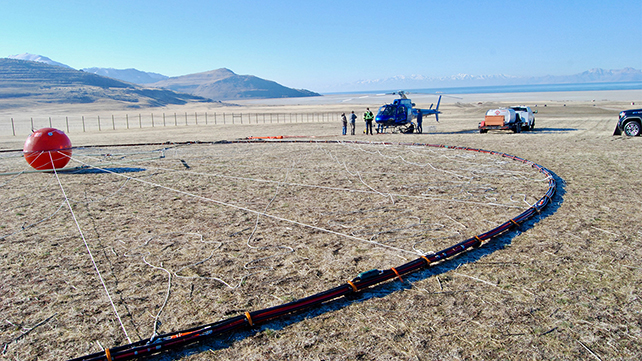
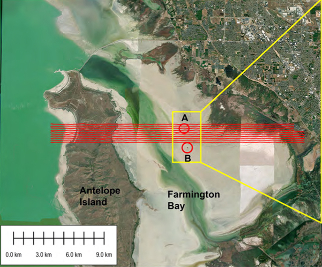
Researchers from the University of Utah deployed a helicopter to carry out an airborne electromagnetic (AEM) survey of part of the lake, covering parts of the Farmington Bay area along the south-eastern edge of the water.
An AEM survey does two jobs: It detects electrical conductivity, which helps differentiate saltwater from freshwater, and it examines rock composition. That means the data can potentially show where freshwater is, and how deep it goes.
The team found that in the surveyed region, there's a sudden and substantial drop in the depth of underlying bedrock below the Great Salt Lake, leaving a massive space for sand and silt to fill – sediment that appears to be saturated with freshwater.
"We were able to answer the question of how deep this potential reservoir is, and what its spatial extent is beneath the eastern lake margin," says geophysicist Michael Zhdanov.
"If you know how deep, you know how wide, you know the porous space, you can calculate the potential freshwater volume."
The researchers estimate that the freshwater reservoir could extend down between 3 and 4 kilometers (up to almost 2.5 miles), though a full survey of the entire Great Salt Lake will be needed to make sure – only a small area of it was scanned here.
It was already suspected that there might be freshwater lurking underneath the Great Salt Lake – in part due to the reed-covered islands that have been popping up across the basin – but this is the first time that researchers have seriously tried to assess how big the freshwater reservoir might be.
And while the presence of freshwater wasn't a surprise, the potential coverage area was. The reservoir discovered by the AEM survey showed the sediment-holding bedrock 'bowl' extending further into the center of the Farmington Bay playa than expected.
Some freshwater would be expected at the margins of the Great Salt Lake, as it feeds down from the surrounding mountains, but the data points to there being a lot more across the approximate 2,500 square kilometers (950 square miles) extent of the lake.
"The unexpected part of this wasn't the salt lens that we see near the surface across the playa," Johnson explained on Utah radio station KPCW's Cool Science Radio show recently.
"It's that the freshwater underneath it extends so far in towards the interior of the lake and possibly under the entire lake. We don't know."
What's more, the researchers think this water could be useful: As the waters of the Great Salt Lake have continued to evaporate, pollution from the remaining dust has become more and more of a problem for the health of surrounding communities.
This dust is regularly blowing into the urban areas of Utah, and taking toxic metals along with it. Some damping down with freshwater may help to mitigate that.
"There are beneficial effects of this groundwater that we need to understand before we go extracting more of it," says hydrologist Bill Johnson.

"A first-order objective is to understand whether we could use this freshwater to wet dust hotspots and douse them in a meaningful way without perturbing the freshwater system too much."
The researchers are already busy trying to get funding to spread out the scope of the AEM survey and analyze more of the lake. In particular, they'd like to chart the boundaries of the sudden drop in bedrock levels.
That should give us a better idea of just how much freshwater could be stored here, and it would also help in water resource planning, and in the study of other similar lakes worldwide that might also be hiding reservoirs.
Related: Strange Living Islands Have Appeared on The Great Salt Lake, And Now We Know Why
Similar techniques could be deployed at other sites, in addition to the rest of the Great Salt Lake, combining magnetic readings to estimate rock depths and electrical conductivity readings to estimate areas of freshwater.
"This is why we need to survey the entire Great Salt Lake," says Zhdanov. "Then we'll know the top and the bottom."
"We use different techniques to study the vertical extent of these freshwater-saturated sediments, to find the depth to the basement."
The research has been published in Scientific Reports.