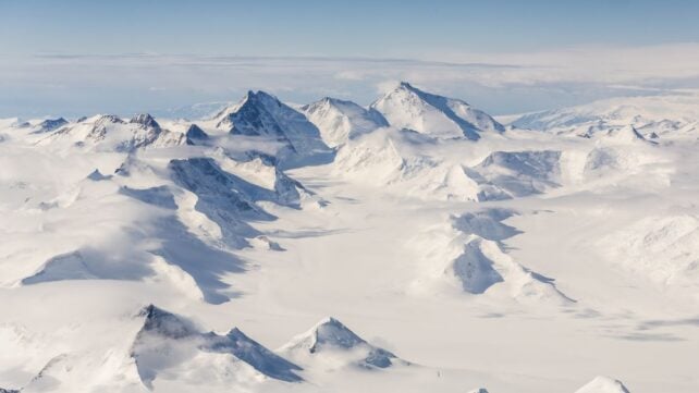
At the world's southernmost reaches, the land is buried under a layer of ice that can reach thousands of meters thick.
Whatever lies underneath has lain concealed for millions of years – an ancient landscape of towering mountains and plunging chasms, lost below a frozen sea of white.
Decades of radar surveys and other geophysical observations have gradually revealed this mysterious buried world, and researchers have now pieced together evidence for a hidden structure on an extraordinary scale.
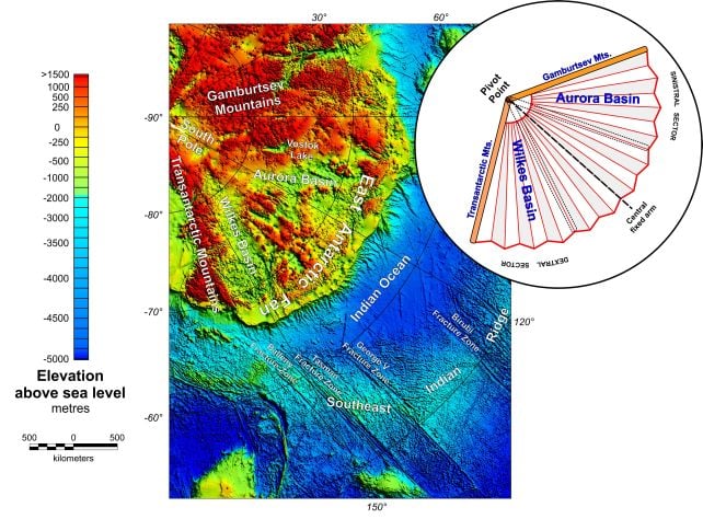
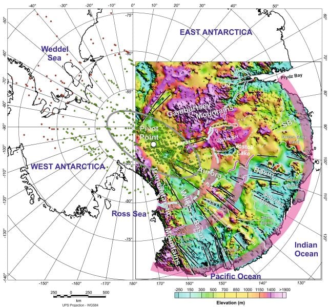
Beneath East Antarctica, a team led by geophysicist Egidio Armadillo of the University of Genoa has identified an enormous, fan-shaped province of about 30 connected basins.
It widens toward the coast, as though someone had taken a corner of Antarctica and tugged it apart around a central inland pivot point.
The researchers have named it the East Antarctic Fan-Shaped Basin Province (EAFBP), and they propose that it formed before the breakup of the Gondwana supercontinent, creating a zone of weakness that may later have helped steer the separation of Antarctica and Australia.
And it may still be shaping Antarctica to this day.
"Because these basins underlie about half of the East Antarctic Ice Sheet, they are likely to heavily influence both ice-flow and landscape evolution, making them essential to Antarctic glacial and hydrological processes," the researchers write in their paper.
The question about the shape of the land underlying Antarctica isn't purely an academic one.
That's partially because the ice isn't just sitting there; it's moving, glacially, and that movement is guided by the contours of the bedrock. We can better predict the speed and direction of the flow if we have a detailed understanding of those contours.
The other big reason is that it's a huge piece of Earth's terrestrial history.
It makes up about 10 percent of Earth's landmass, and many questions about Gondwana, continental breakup, ancient mountain building, and crustal evolution have an Antarctica-shaped hole in them because we can't directly see most of the continent.
Interestingly, the researchers did not set out to find a fan-shaped geological structure spanning a substantial proportion of Antarctica.
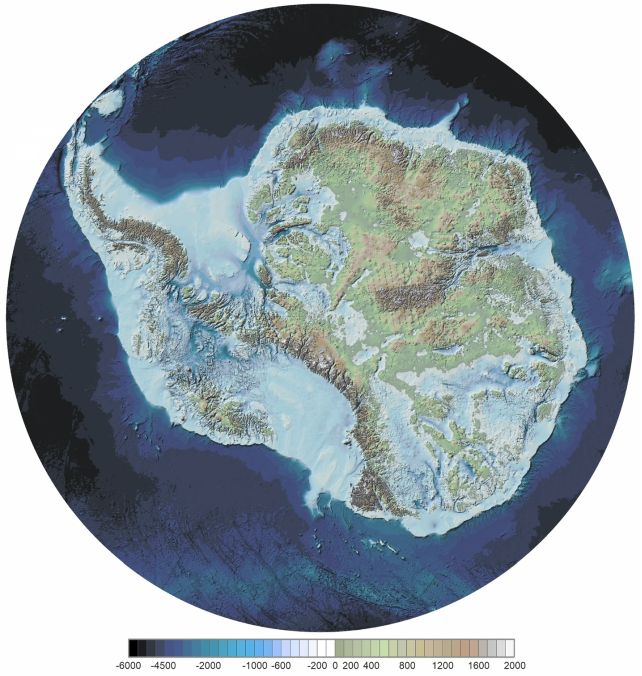
Rather, they were investigating what East Antarctica would look like if the ice were removed – which is not the same thing as what the radar images show under the ice.
There are an estimated 27 million cubic kilometers of ice covering Antarctica, and it's not just sitting there. All that mass pushes the bedrock downward. If the ice disappeared, the land would bounce upward, gaining as much as a kilometer (0.6 miles) in altitude.
The researchers combined reconstructed rebound topography with radar, gravity, seismic, and magnetic data to investigate the buried landscape.
And, as they examined the reconstructed topography, they noticed something peculiar.
Many of the major subglacial basins in the area seemed to have the same basic geometry – not random depressions, but fanning outward from a common, central point near the South Pole – what they describe as a "coherent continent-scale radial pattern".
The geometry bears a striking resemblance to a type of tectonic feature known as a sphenochasm, described in 1955 as "the triangular gap of oceanic crust separating two cratonic blocks with fault margins converging to a point, and interpreted as having originated by the rotation of one of the blocks with respect to the other."
The researchers compiled a list of processes that could have sculpted the EAFBP from Antarctic bedrock. Several mechanisms can create large basins, including inherited structures, rifting, glacial erosion, and crustal stretching.
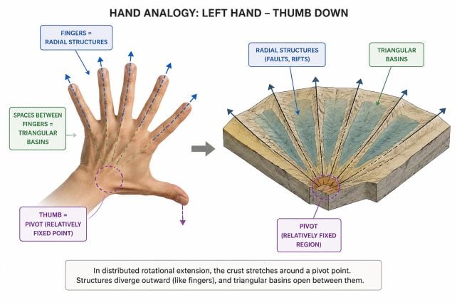
However, the radial arrangement of the Antarctic basins, together with patterns in crustal thickness and topography, matched most closely with a process known as rotational extension, in which the crust spreads outward from a pivot point like an opening handheld fan.
This becomes easier to appreciate when you look at the map, with ridges radiating outward like the ribs of a fan, opening along a stretch of coast some 2,000 kilometers long.
If this interpretation of the structure is correct, then it may preserve evidence of tectonic activity that preceded the breakup of Gondwana and clues about Antarctica's eventual separation from Australia.

It may also help explain Antarctica's other features, such as the towering Gamburtsev Subglacial Mountains and Transantarctic Mountains that border the EAFBP.
Related: Giant Gravity Anomaly Under Antarctica Is Getting Stronger, Scientists Reveal
As the fan opened up, the researchers propose, the motion could have increased uplift in those regions, raising mountain ranges that today rank among Antarctica's most prominent hidden features.
It's not a perfect explanation. The timing of the process is difficult to constrain, and the feature could represent multiple episodes of extension that superimposed each other. Future investigation will focus on refining this aspect.
Antarctica still represents a frontier that is difficult to penetrate. Little by little, however, scientists are discovering its secrets – and with them opening a window to a long-lost ancient world.
The research has been published in Nature Geoscience.