Due to tectonic shifts, the entire continent of Australia has moved 1.5 metres north over the past 22 years, putting it out of sync with global positioning systems (GPS).
To fix the problem, the government's announced that the country's latitude and longitude will officially be updated to reflect the continent's new position.
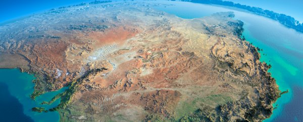
The Australian plate is the fastest continental plate on the planet, moving northwards and slightly to the east by about 7 centimetres each year.
All that movement can build up tension that eventually releases in the form of an earthquake, but the most immediate result is that it drags the entire landmass of Australia closer to the equator year after year, which means the country isn't actually where we think it is anymore.
Right now, digital maps know where a country is supposed to be based on detailed coordinates supplied by the government. So if you're looking at Google Maps, your phone has already been searching for a signal sent out by one of the many GPS satellites orbiting the planet.
And based on the positioning information that comes back, your phone is able to figure out your longitude and latitude, and place you on the map based on your country's official coordinates.
But for Australia, those coordinates were last updated by the national body - the Geocentric Datum of Australia (GDA) - in 1994, and since then, the continent's moved more 1.5 metres.
A 1.5-metre discrepancy isn't a huge issue for those of who just want to use Google Maps to figure out the fastest route home, because GPS technology on our smartphones is only accurate to within 5 to 10 metres anyway.
But as technology improves and we start to rely on GPS to do things like navigate self-driving cars, we're going to need the measurements to be a whole lot more accurate.
"In the not-too-distant future, we are going to have possibly driverless cars or at least autonomous vehicles where, 1.5 metres, well, you're in the middle of the road or you're in another lane," Dan Jaksa from Geoscience Australia told ABC News.
"So the information needs to be as accurate as the information we are collecting."
To fix this problem, the GDA has announced that it will officially be updating the country's coordinates in 2017, based on predictions of where the country will be in 2020 - almost 2 metres further north than where the GDA says we are now.
That means for three years, the new coordinates will also be slightly out of sync while the continent catches up with our updated longitude and latitude, but they'll be a whole lot more accurate than they are now.
The national body is also looking into how they can keep the numbers more up-to-date in the future.
"We have points on Australia that are fixed to Australia and the lines of latitude and longitude move with those points," Jaksa told ABC.
"The lines are fixed to the continent but as time goes by, that position compared to a GPS position can create a difference, so every so often we need to change that."
Things get tricky because massive tectonic shifts, such as earthquakes, can also change the longitude and latitude of a continent.
Back in 2004, a magnitude 8.1 earthquake occurred in the Pacific Ocean just one day before the Indian Ocean tsunami, and it shifted the distance between mainland Australia and Tasmania by millimetres. And after last year's Nepalese earthquake, the Himalayas actually shrunk by 1.5 metres.
It's easy to forget, but our planet is constantly moving. We just need to find a way to keep up.
UPDATE: We've updated this story to fix a factual error about GPS and smart phones. The earlier version stated that smart phones bounced signals up to a satellite, whereas they actually are just receivers of GPS satellite information.